If you are planning a sailing trip in the British Virgin Islands, you’ll want to make sure to familiarize yourself with what is off-limits. These BVI areas are so-called redlined on charts.
Take note that each charter company has different rules. Just because White Bay is redlined by one, does not mean it is off-limits with the Moorings (I believe you can go there with them).
So, make sure to check with them for the latest information during your chart briefing. We also go through them again with the crew during my yacht charter skipper's brief.
Regardless, it’s a great idea to understand each of these areas well and to exercise extra caution if you are allowed to go there. There is a reason some charter companies have made certain areas off-limits...
And as always, do not use any of this information for navigational purposes - it’s informative, but leave it at that. Stick to your charts and local knowledge provided by the charter company.
Here are the BVI redlined areas I am going to cover (there are more, but these are the big ones).
Channel between Little Camanoe and Beef Island near the airport
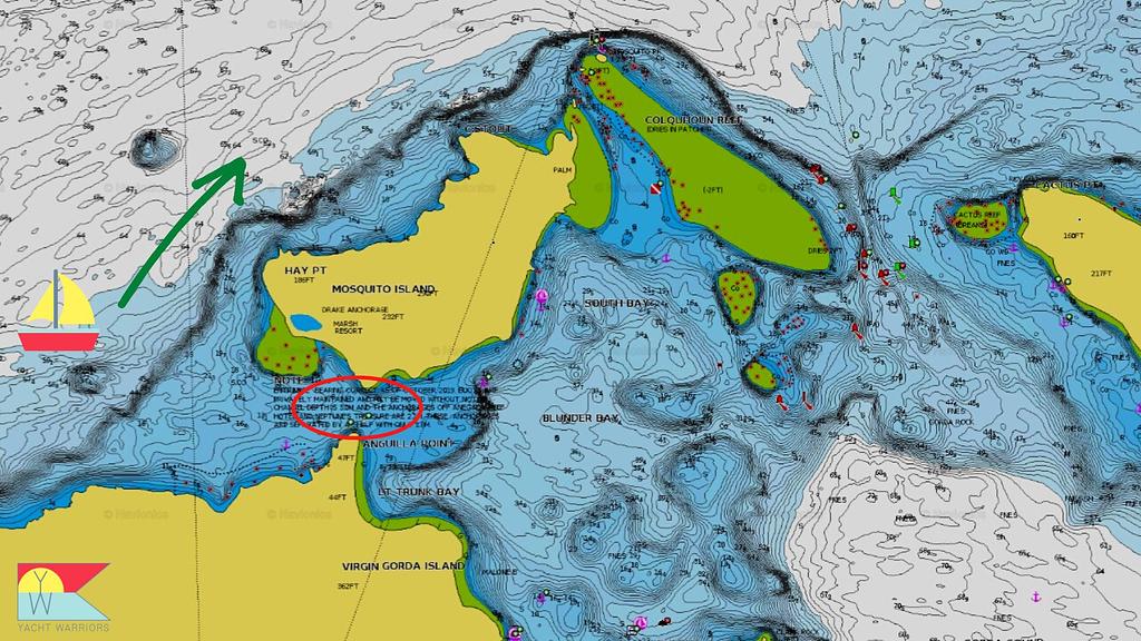
Channel into North Sound between Virgin Gorda and Mosquito Island
Eustatia Sound
Anegada (other than the main anchorage)
Brewers Bay
White Bay
The redlined passage between Little Camanoe and Beef Island | Source: Navionics
Channel between Little Camanoe and Beef Island near the airport
Please, 100% make sure you know where this one is on charts. It has probably claimed more charter boats and VISAR responses than anywhere else in the BVIs.
Here are two examples.
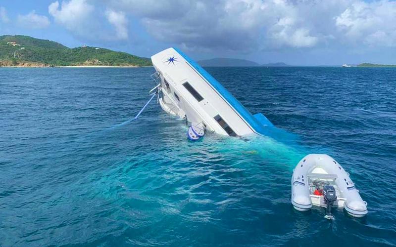
Reports were that they ventured too far west trying to avoid traffic
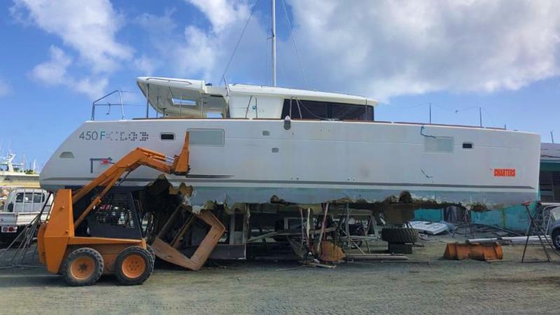
Aftermath of this Lagoon 450 that struck the reef in 2021
Why is it redlined?
On charts, it looks somewhat innocent, but there is actually a large reef/rocks right in the middle of the channel.
It is marked by a buoy(s), but at times these can be missing. If you aren’t paying attention to your charts and are in the middle, you are very likely going to hit the reef.
If you are passing through this area, the correct passage is the channel between Little and Great Camanoe.
The redlined passage between Mosquito Island and Virgin Gorda | Source: Navionics
Channel into North Sound between Virgin Gorda
This one is tempting for shallow draft vessels, especially at high tide. Leverick Bay is right there on the other side! You’d be tied off to a mooring ball with a beverage in no time.
Patience. Spend the extra 15 minutes to motor (or sail) through the well marked channel on the north side of the sound.
Why is it redlined?
Easy - it’s shallow and unmarked. Some charter vessels also don’t have the draft to get through this one.
You may even see yachts use this channel. Don’t be tempted unless you have local knowledge, shallow draft, and are not violating your charter company’s off-limits areas.
Overview of the Eustatia Sound area | Source: Eustatia Island
Eustatia Sound
This one is somewhat of a head scratcher for me since I really like this anchorage. I’ve even stayed on the hook overnight (no it was not redlined at the time).
There’s a lot to like about this area - white sandy beaches at Prickly Pear, snorkeling at the reef, good holding, and solitude. I write more about what to do here in my post about BVI anchorages.
If not off-limits, give it a shot in settled conditions. You can also dinghy over here easily from North Sound mooring balls.
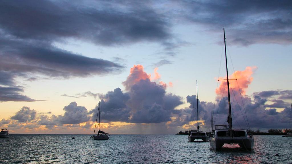
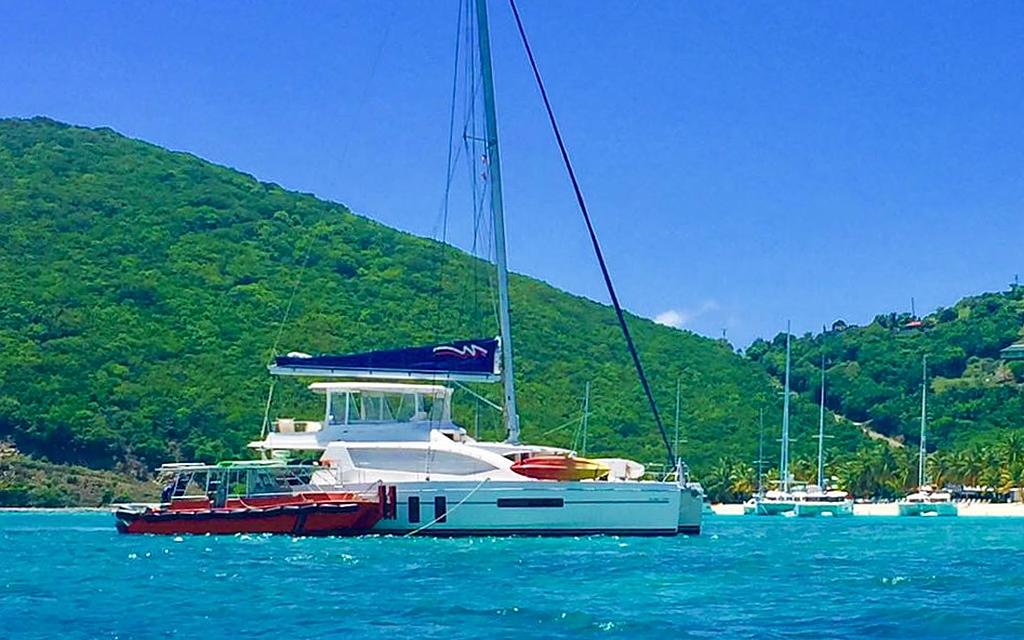
Our catamaran lying at anchor on a trip to the BVIs several years ago
Why is it a BVI redlined area?
I think there are 2 explanations:
It’s exposed to northerly swells, which can catch ill-prepared skippers off guard if one shows up in the middle of the night. Read more about northerly swells and other marine conditions to be aware of in my post on BVI weather
The approach from inside North Sound past Saba Rock requires careful navigation (there is an easier approach from the north)
Sunset at Setting Point Anegada
Anegada (other than the main anchorage)
Most, if not all charter companies, now allow charter boats to sail to Anegada. You should not miss out! It was my favorite British Virgin Islands destination - north shore beach exploring, great snorkeling, and fresh spiny lobster are reasons we go.
The channel is (usually) well marked, and the approach straightforward. Although, you do want to take extra care in your navigation.
If you go, most companies ask you to limit your visit to the main anchorage.
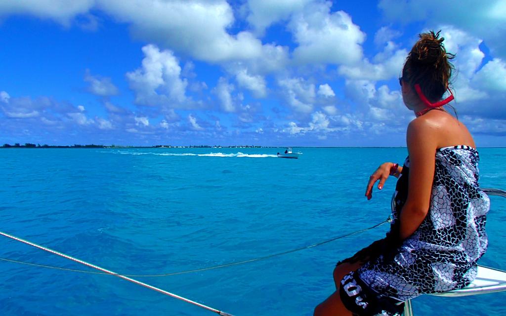
Bow watch set as we approach the shallows around Anegada
Why are other areas of Anegada redlined?
Uncharted reefs and shallow areas that require local knowledge - that simple. This includes Pomato Point which is an anchorage next door to Setting Point.
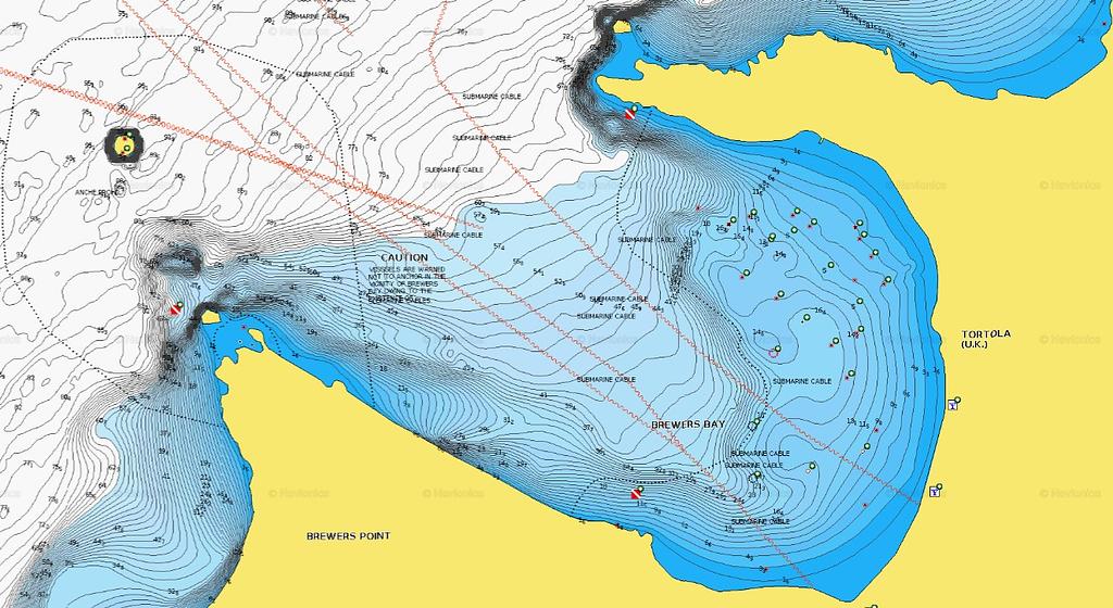
You'll have an undersea cable and reefs to negotiate if you go to Brewers Bay | Source: Navionics
Brewers Bay
Some companies may allow you to go to Brewers Bay for a day stop, but I believe it’s off limits for overnighting by all.
Brewers Bay is located next door to Cane Garden Bay on Tortola and remains one of those somewhat undiscovered bays (since it’s mostly off-limits!).
If it's not off-limits and you visit, enjoy the view, solitude, and spectacular snorkeling.
The beach at Brewers Bay is quite appealing!
Why is it a BVI redlined area?
It’s exposed to northerly ground swells in the winter months (see my weather link above)
There are lots of reefs, including one right in the middle that juts out from shore
There is an underwater cable that you need to make sure not to foul
Looking at it on charts it just appears, well, crowded with obstructions.
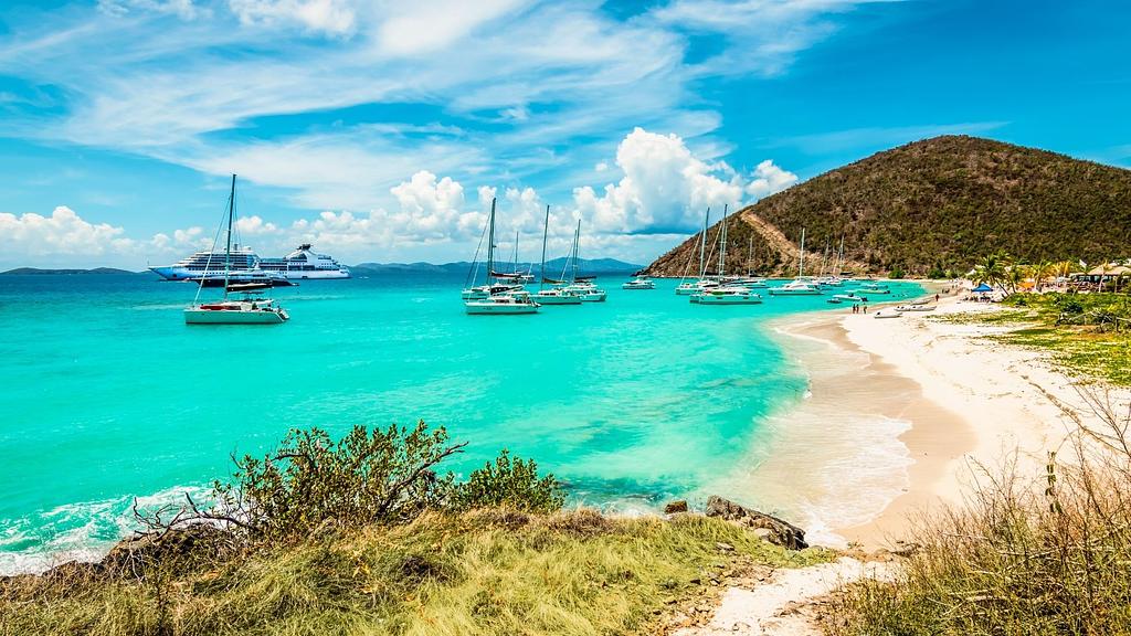
White Bay
White Bay: a rather notorious BVI redlined area
Ah, White Bay. One of the pearls of the British Virgin Islands. A perfect, white sandy bay lined with beach bars and palm trees.
It also plays host to a lot of boating incidents! I talk all about it here and why I may not anchor here overnight anymore. I also give suggestions on where else you can go in the area to still enjoy White Bay.
A 50 foot Moorings cat that barreled straight over the reef and grounded hard
Why is it redlined?
It’s a tight anchorage and it gets very crowded in peak season, especially on the west side. Some charter companies have learned the hard way.
If there are thunderstorms forecasted, it’s best to avoid. Boats have been thrown up on the beach or the reef when an unsuspecting squall rolls through. By the time one is upon you, it’s unlikely you’ll have time to get the boat in gear and take action.
Explore these related articles from the Yacht Warriors
Get fresh ideas for your next yacht charter trip - insider guides, sailing itineraries, planning tips, and more. Subscribe and receive my free BVI Trip Planning Document.
Genuine sea stories
From hidden coves to the best anchorages, I share my first-hand experiences to enrich your next voyage.
Exclusive insights, twice a month
Our newsletter is your gateway to the secrets of successful chartering, delivered at no cost. Plus, the freedom to unsubscribe anytime.


.jpg)
.jpg)
.jpg)
.jpg)
.jpg)


