Sailing to St. Croix: A Fresh USVI and SVI Sailing Itinerary
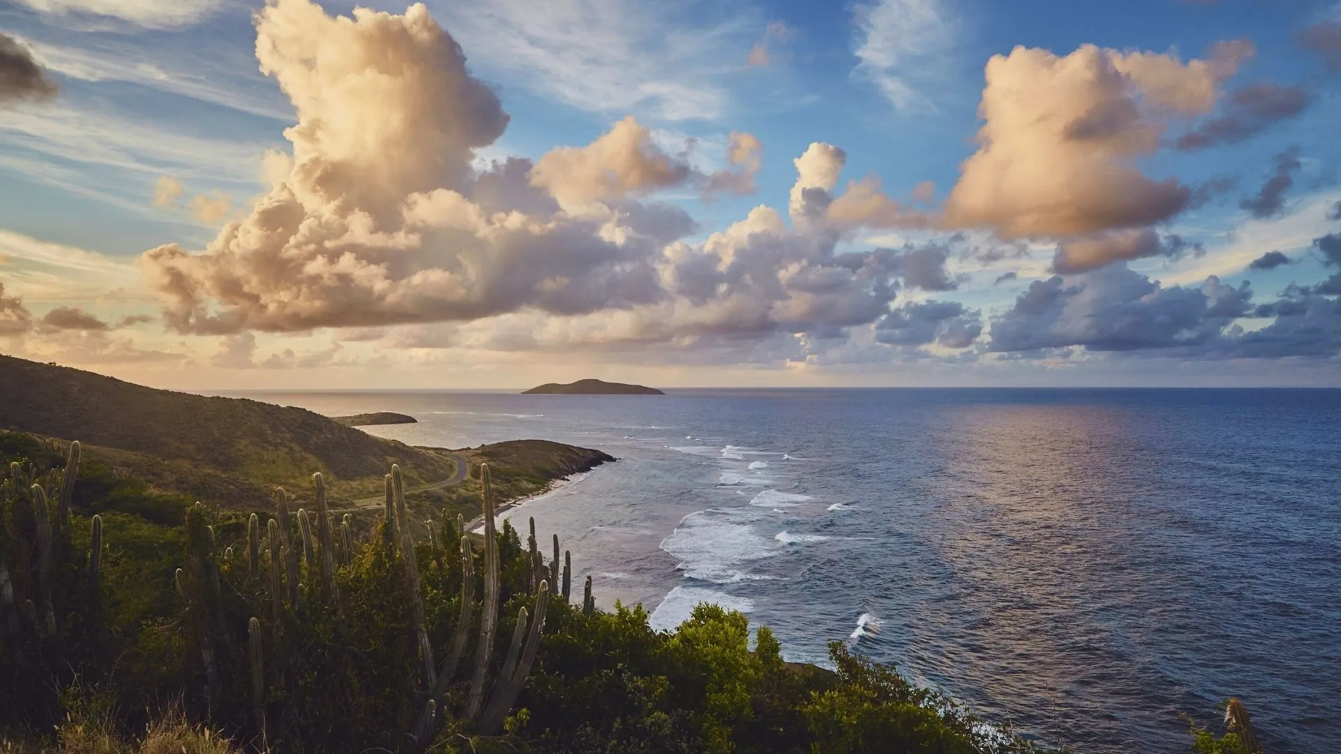
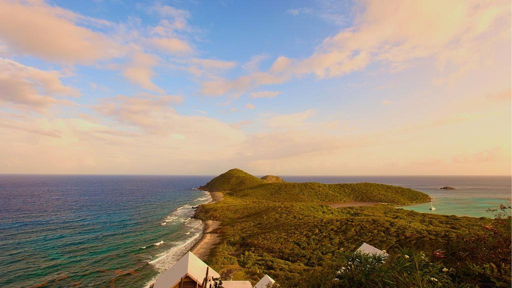
Photo: Buck Island as seen from Point Udall - the easternmost point of the US
Thinking about visiting the BVIs again for your next bareboat charter sailing trip?
Think again.
Let’s ditch the tried and true and mix it up with a fresh, exciting sailing itinerary that few charter boats attempt.
My plan calls for a week in the US Virgin Islands and Spanish Virgin Islands. Specifically, we are going to go sailing to St. Croix from St. Thomas. Next we'll continue clockwise to Culebra, SVI.
No, we won’t spend much time in St. John or Vieques. We’ll save those for another trip. There just isn’t enough time in a week to properly do those justice.
And yes, this is the plan for my next sailing trip coming up in November 2022. It’s going to be a guys trip on a sailing catamaran. Update: here's the trip report.
Here’s what we are looking for and why this sailing itinerary might work for you:
Several longer days on the water with some chill days to mix it up
Two days of open, deepwater crossings, including sailing to St. Croix and back. In ideal trade wind conditions, you may not even have to make a single sail change.
Excellent opportunities to catch some mahi, tuna, and wahoo from your sailboat
Lots of schedule flexibility if the wind becomes too strong for comfortable crossings - remain in the protection of St. John, or head straight to Culebra
Off the beaten path – fewer charter boats visit these areas
Clearing customs is easy into the SVI with the CBP ROAM app, and not required for entering USVI from SVI (and there is no check out required). I describe how to do this below.
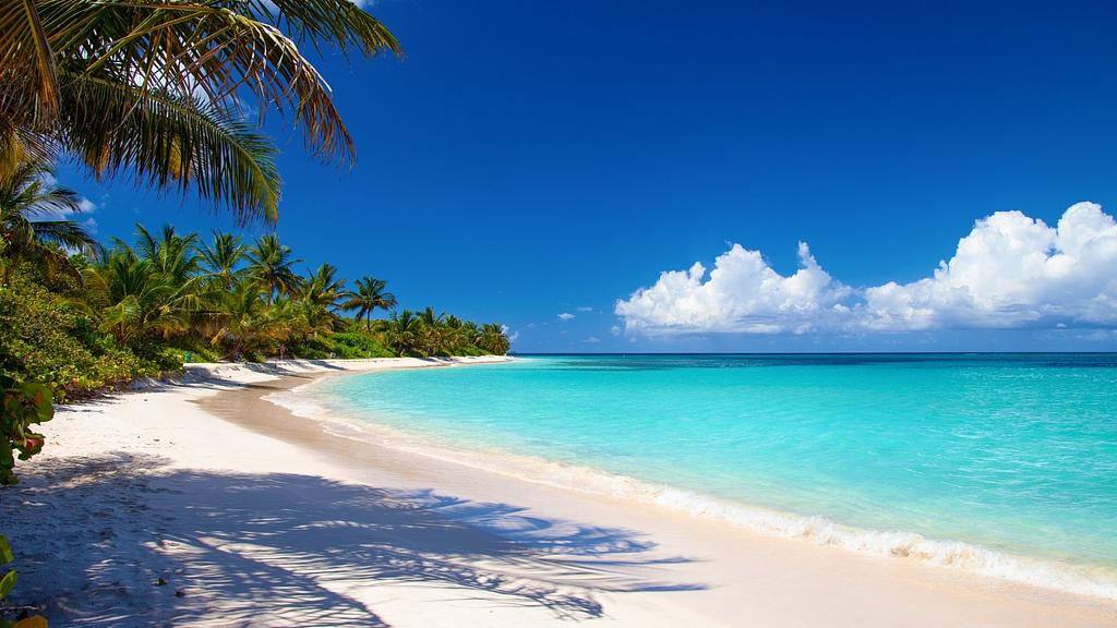
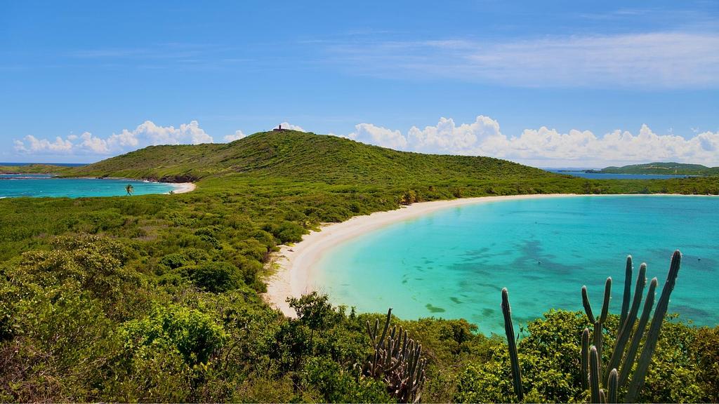
Flamenco Beach on the north side of Culebra - a global top 10 beach
Why Culebra and sailing to St. Croix?
I first visited the Spanish Virgin Islands in 2020 and was blown away. Laid back vibe, gorgeous beaches, and phenomenal snorkeling are some of the features drawing me back. I can’t wait to return and continue exploring!
Culebra (and Vieques) have been described as what the British Virgin Islands were about 30 years ago before they became popular. Better hurry before the word gets out.
If you have more than a week for this trip, consider adding a day or two at Vieques. Green Beach, Sun Bay, and Ensenada Honda are all worth a stop. If you can, navigate clockwise so you sail downwind with the current in your favor.
St. Croix makes the list for this sailing itinerary since it’s off the beaten path. I love checking out new places that might be out of reach to others. It also allows us the opportunity to get two awesome days of sailing in open water.
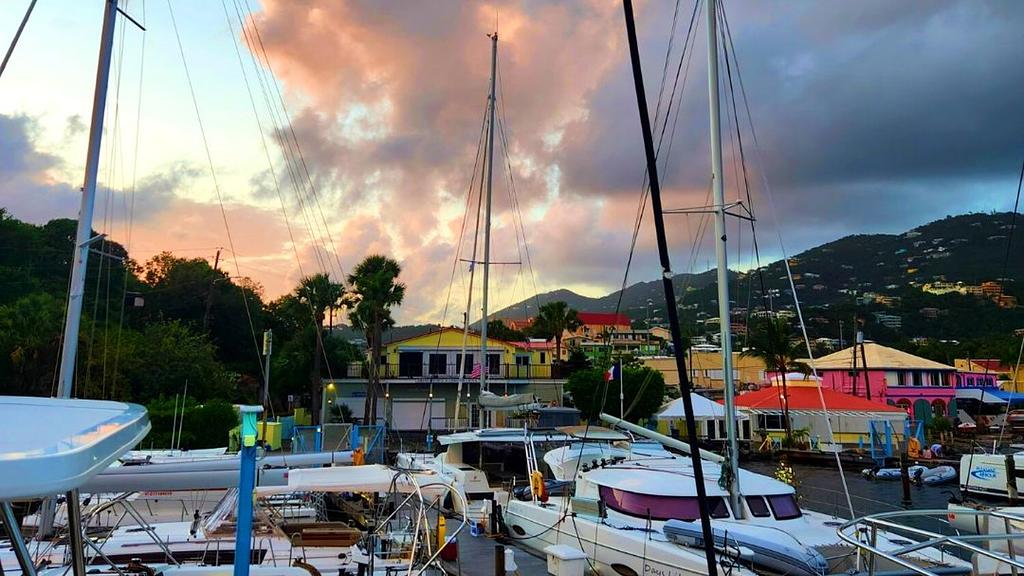
Frenchtown Marina near Charlotte Amalie in St. Thomas, one of the charter bases
Should you charter from Puerto Rico or St. Thomas?
My pick would be St. Thomas, but either one will work. A few things to consider:
Charter fleet availability
There are more operators, and sailing yachts available in St. Thomas, USVI. This means you might have a better chance of finding a suitable sailboat that fits your schedule (pro tip, let the Yacht Warriors help you!)
Logistics
Consider where you are flying from. Does it offer a direct flight to San Juan, PR or St. Thomas? This might be enough reason alone to do one or the other.
Itinerary planning
You can pull off my itinerary below from either Puerto Rico or St. Thomas, but keep in mind leaving from Puerto del Rey will add about ~40 nautical miles roundtrip to the journey.
Provisioning
No problem from either with plenty of options available. I love visiting Costco in Puerto Rico, but the good news is that St. Thomas has a similar store - CostULess. Provisioning isn’t a factor that would sway me either way.
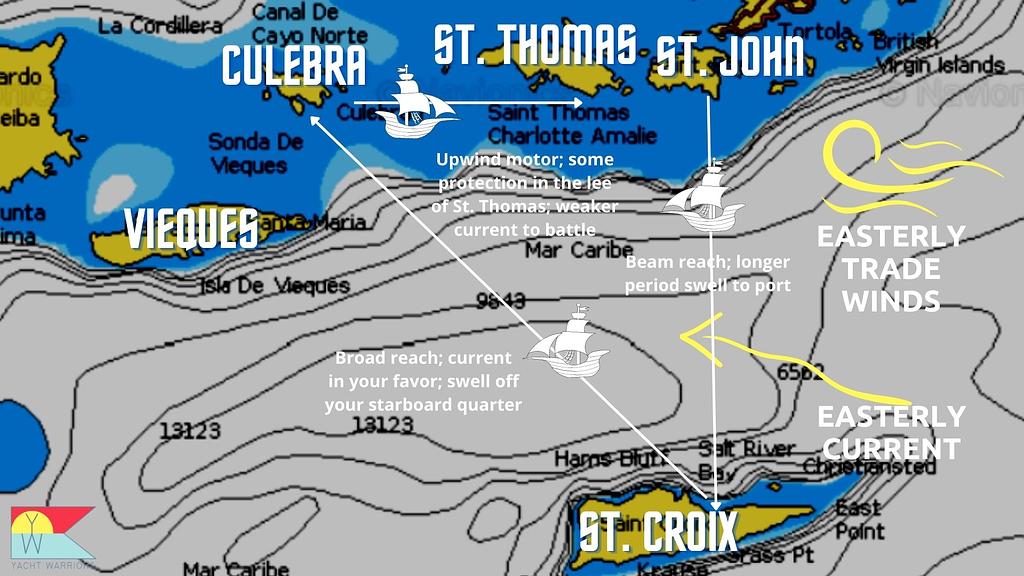
Cruising conditions for what you can expect when sailing to St. Croix
Why this itinerary design works:
I take you clockwise to take advantage of prevailing marine conditions, allowing for more comfortable cruising conditions with your crew
Easterly trade winds
The long fetch of the trades will produce wind swell that you want to avoid sailing/motoring directly into
Your crossing almost due south should be on a beam’s reach
Heading back north from St. Croix to Culebra will be a nice, broad reach with the swell on your quarter
Always check the forecast!
In stronger winds (15+ knots), even with a favorable wind direction, the larger swell could make things too uncomfortable for a crossing
Current: the prevailing current in this part of the Caribbean is 0.5 - 1.0 knots from the east/SE. This puts the current in your favor for the longer crossing from St. Croix to Culebra
When you travel back east to St. Thomas from Culebra, you will have an upwind slog (no avoiding it)
You should get some protection in the lee of St. Thomas from the long fetch of the trade wind swell
The current that you’ll have to fight will also be weaker closer to St. Thomas
CBP
Clearing customs between USVI and the Spanish Virgin Islands
OK, here’s what you need to do to make this go smoothly. It really isn’t that hard.
USVI to SVI (St. Croix to Culebra)
Clearing out of USVI
Checking out is not required. Hooray! Celebrate with a frosty Carib.
Clearing in to Puerto Rico (SVI)
If your crew is all U.S. citizens, make sure you have downloaded the latest version of the CBP ROAM app and previously completed your initial videoconference interview
You can do this in St. Thomas before you depart
Upon completion you’ll receive your Verified Traveler numbers.
Add your crew members in the app - have your passport or Global Entry info handy
Next, add your mode of travel - Pleasure Boat. You’ll need some info such as the vessel registration number and the CBP user decal number
Check with your charter company if you are uncertain. Most USVI based charter boats should be set up to use the ROAM app. The boat needs a DTOPS sticker
Technically, you need to be at the port of entry to report your arrival. This means anchored in Dewey, Culebra. Some people have been known to request the check-in when several miles out
Once you report your arrival, the CBP officer may get in contact, but they may also just clear you for entry
On rare occasions, they could still request that you show up in person.
If you are not U.S. citizens, you’ll need to visit the CBP office at the airport in Dewey (787) 742-3531)
Clearing out of Puerto Rico (SVI)
Again, nothing is required here.
SVI to USVI
Nothing is required to re-enter the US Virgin Islands from Puerto Rico.
Ram Head in the distance and the Salt Pond Bay anchorage
A week sailing the US and Spanish Virgin Islands
Day 1: Stage for the crossing at St. John, USVI
Once you are underway, motor about 15 nautical miles east to pick up a National Park Service (NPS) mooring at Salt Pond Bay. This will be our staging point before we go sailing to St. Croix. It’s conveniently located about as far south as you can be on St. John.
There are five balls available. If they are all taken, you can work back west a bit to Great/Little Lameshur Bay where additional balls can be found. No anchoring is allowed in these bays.
Get settled in, enjoy your first night out of the marina, and grab a cocktail for a killer sunset. Consider a hike to Ram Head point. The trail can be easily found ashore at Salt Pond Bay.
If you have some time and want to do additional exploring, consider Coral Harbor around the corner for a day stop. It’s home of the well-known floating taco bar: LIME OUT.
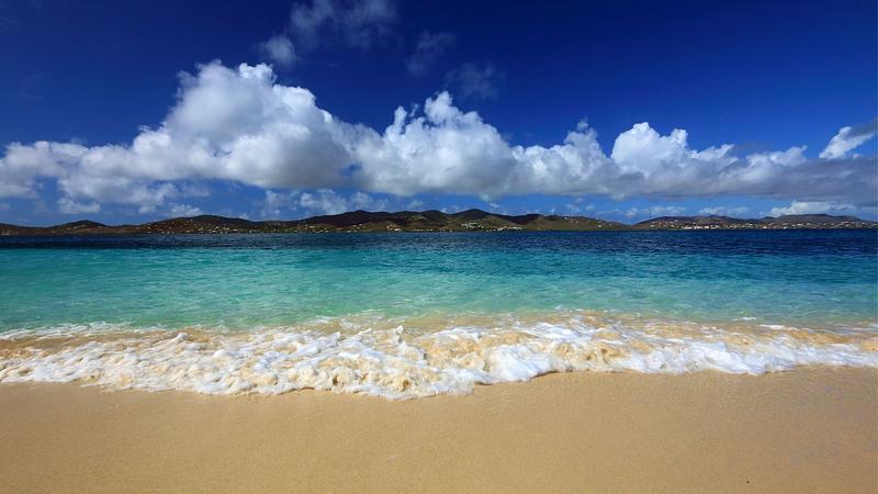
Some people believe Christiansted is the most beautiful Caribbean city
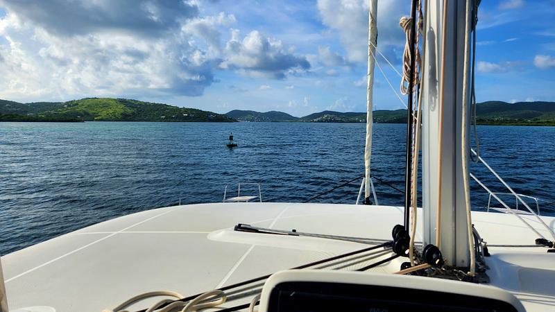
Day 2: Sailing to St. Croix: our first deepwater crossing south
Get an early start and get that fishing equipment prepped! Crank the sailing tunes. It’s time for some epic sailing and fishing.
From Ram Head, it’s about 32 nautical miles to the channel markers at the entrance to Christiansted. With 10-15 knot winds that should make for a 4-hour trip.
You have a couple options for anchorages once you arrive. Pay careful attention to charts and your cruising guide if you enter Christiansted.
Off the beach at Altona Lagoon - use this if you want to dinghy ashore and explore the island. It’s not recommended to use the anchorage marked behind Protestant Cay - much of this area is taken up by a large mooring field for full-time cruisers
In the lee of Green Cay, if you don’t plan to go ashore
Buck Island Reef National Monument - you’ll need to apply for a NPS permit to anchor here. Allow 5 days.
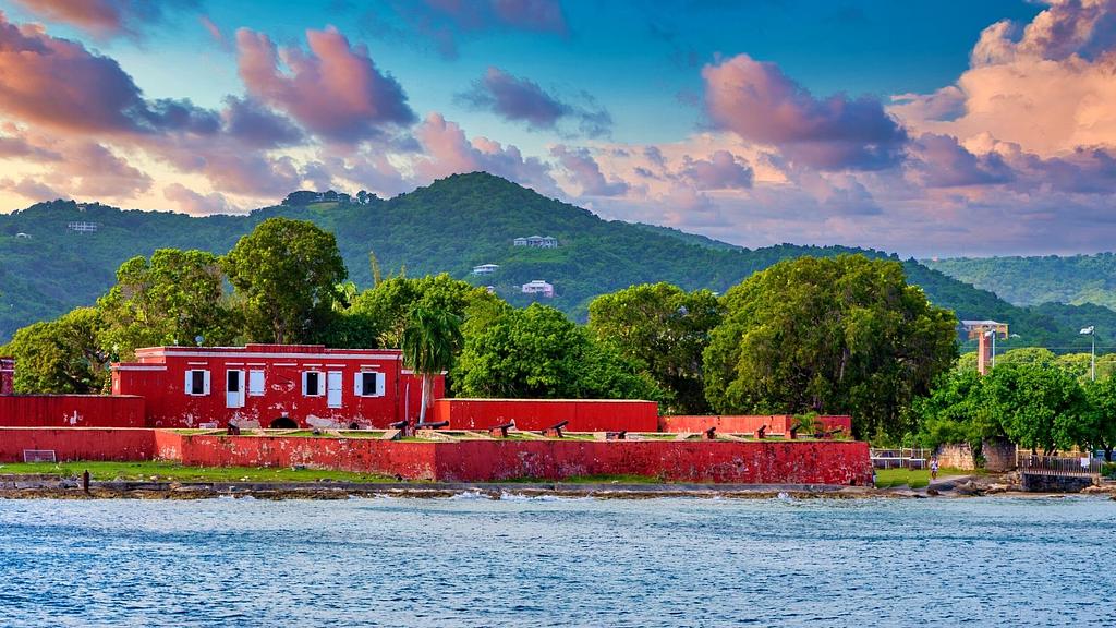
Fort Frederik on the West End
St. Croix is considered the garden island and is known for it’s picturesque Dutch architecture. Many people believe Christiansted is one of the prettiest Caribbean towns.
For my trip plan, I will only stay one night at St. Croix, but feel free to add another day or two if you want to really explore the island. The Cruising Guide to the Virgin Islands has some recommendations for a day tour. Cars can be rented easily at Christiansted.
Frederiksted on the west end of the island is another option with excellent protection from the easterly trades.
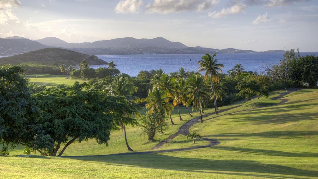
If I had an extra day, I might even try and squeeze in a round of golf. The Buccaneer Golf Course is nearby and has many distracting views of the ocean!
Buccaneer Golf Course in St. Croix
After lunch, shopping in Christiansted, and some history at Fort Christiansvaern, I would move our yacht to the Buck Island Reef and spend the night there in solitude.
Get to the NPS site early enough to take advantage of the famous snorkeling at the Underwater Trail inside the lagoon.
If you’re lucky, you’ll have some fresh mahi fillets to whip up into fish tacos. Could you ask for anything more??
One of the beaches at Buck Island, looking back towards St. Croix
Heading through the channel to Dewey, Culebra to get checked in
Day 3: Let’s go visit the Spanish Virgin Islands
OK - this is the last day I’ll get you up early.
Today is a bit longer than the last, but the sailing might even be sweeter, so it’s worth it. From Buck Island, it’s about 48nm to the channel entrance to Ensenada Honda (Dewey). Plan for 6-7 hours on a broad reach.
It’s also another great day for fishing!! If you are serious about it, you can veer more to the north and pick up the South Drop. Lower your sails and motor the rest of the way to Culebra, zig zagging across the drop in 200-600 feet of water. Get that gaff ready for a monster wahoo.
Bajos Grampus (Grampus Banks), about 2nm SE of Culebra, is another fishing spot worth checking out. It’s a couple sea mounds that rise from ~70 feet to about 15 feet from the surface. A lot of fish can be found on them. Test your hand here with some bottom dropping. If you’re a free diver, this is a great place to search for lobster.
Once in Dewey, anchor in 15-20 feet of water between Cayo Pirata and the town dock. Complete the clearing in process (described above).
If you want to grab a bite for dinner, you can remain anchored close to town. There are plenty of options within walking distance from the dock. It’s also a good time to provision fresh supplies if you need it.
If I had time, I would move to the moorings at Ensenada Dakity, the reef anchorage near the channel entrance. Here, you are exposed to the trade winds, but the reef provides excellent protection from the swell.
Ensenada Dakity anchorage in Culebra
In Dakity, be careful of the front row or mooring balls, it can get quite shallow.
Cayo Luis Pena, viewed from the south
Day 4: Explore the Cayos west of Culebra
It’s time for some snorkeling and scuba diving.
The Cayos to the west of the main island of Culebra provide excellent opportunities for exploring the brilliant underwater marine life of the SVIs.
Take your pick or snorkel sites. Much of this area is part of the Culebra National Wildlife Refuge - designated such to protect seabird and turtle species. Activities such as fishing are prohibited and the islands can only be explored from sunrise to sunset.
Check your Puerto Rico cruising guide for details on the anchorages. It’s a combination of day anchorages and Department of Natural Resources (DNR) mooring balls. For some of these it’s OK to stay overnight.
Cayo Luis Pena is the largest island. It has a great white sand beach on the northern side and a hiking trail that runs to the southern part of the island.
Killer sunset over the Cayos to the west of Culebra from one of our recent trips
For overnighting, I’d recommend the moorings at Carlos Rosario beach (unless there is a strong northerly swell running). It’s a perfect place to enjoy an unobstructed sunset over the Cayos to the west. Technically they are day use only, but I haven't seen this enforced.
Anchored our Lagoon 46 charter yacht on a recent trip right in front of the beach
Day 5: Beach day at Playa Flamenco
Today is a beach day, and we are going to chill at world renowned Flamenco Beach.
We have two options to get there. We can hike right from Carlos Rosario (check out my post on the Spanish Virgin Islands where I talk more about the hike) or better yet, we are going to anchor right in front of the beach.
To do this, you’ll need settled weather. Make sure there isn’t a northerly swell and ideally there will be <15 knots blowing with the easterlies. Also confirm this area isn’t redlined by your charter company.
You may have seen pictures of the beach with abandoned tanks the U.S. Navy used to use for target practice. Well, that’s Flamenco.
The beach setting is stunning and I will be content to relax with some cold ones and my toes in the sand. There are several food stalls that sell cheap beer and snacks on the eastern end of the beach.
Flamenco is a day anchorage only because you don’t want to be caught here if conditions turn unfavorable.
Raise your anchor and continue east around the northern Culebra to Culebrita. If you thought Flamenco Beach was awesome, wait until you see Playa Tortuga.
Make sure to stay overnight at Culebrita in settled conditions only. Otherwise you might be in for an uncomfortable night on a mooring ball. If the weather looks iffy, pick up a free mooring ball at Bahia de Almodovar (Las Pelas) behind the protection of the reef.
You can return to Culebrita the next morning.
Culebrita
Day 6: Explore the gem of the Spanish Virgin Islands - Culebrita
I would plan to spend the entire day here. Hike to the lighthouse and visit with the goats for panoramic views of the neighborhood.
Snorkel the nearby reefs. Check out the jacuzzis on the north side of the island. Or just sit and relax under a coconut palm on the white sand beach.
If you’re feeling adventurous and the conditions are settled, take the dinghy to explore Cayos Geniqui about a mile to the north. Or, closer to the anchorage, visit the dive spot marked on charts near Cayo Botella.
Magens Bay
Day 7: Back to St. Thomas for our last day
This is somewhat of a free day - we just need to be anchored close to our marina for check out procedures the next day.
Here’s what I would do. I’d get an early start and head to the famous north drop for a last bit of deepwater fishing (assuming the trades aren’t blowing too hard).
For a quick lunch stop, we’ll pull into the bight at Magens Bay, home to another well-known beach. You can anchor close to shore. If you have time, dinghy to the beach to check out the local action.
Ashore you’ll find a perfect white sandy beach and Magens Point Bar and Grill for a couple of cold ones. If there are cruise ship passengers in the area, you might want to stay away!
After lunch we’ll head to Water Island for our final overnight anchorage. Allow yourself at least 1.5 hours to motor over there. If it’s crowded use Lindbergh or Flamingo Bays as back ups.
Ashore, Dinghy’s Beach Bar and Grill is an excellent choice to enjoy a final Caribbean sunset and celebrate a great trip with friends or family.
Explore these related articles from the Yacht Warriors
Get fresh ideas for your next yacht charter trip - insider guides, sailing itineraries, planning tips, and more. Subscribe and receive my free BVI Trip Planning Document.
Genuine sea stories
From hidden coves to the best anchorages, I share my first-hand experiences to enrich your next voyage.
Exclusive insights, twice a month
Our newsletter is your gateway to the secrets of successful chartering, delivered at no cost. Plus, the freedom to unsubscribe anytime.


.jpg)
.jpg)
.jpg)
.jpg)
.jpg)
.jpg)

.jpeg)
