Crewed Itinerary · Balearic Islands · Mallorca

Sailing Mallorca: A 7-Day Tramuntana Coast Charter from Palma

Most yacht charters in the Mediterranean stay on the southern, easier side of Mallorca. This one doesn't. The week runs west and north up the island's rugged Tramuntana coast. Granite mountains drop straight to the water. The best anchorages can't be reached from any road. The fishing harbors haven't changed character since the 1920s. Cabrera National Park closes the week, south of Mallorca and accessible only by yacht.

The route is a 180-nautical-mile round-trip from Palma. Sailing yachts and modern catamarans both work it well; motor yachts cover the longer Tramuntana legs in less time. Embarkation is at Palma, fifteen minutes from the airport. Prime season runs late May through early October.

Duration
7 days / 8 nights
Base
Palma de Mallorca
Plan your Balearics charter Custom-tailored to your dates and group preferences
Palma marina with Cathedral La Seu in the background — embarkation morning.
Port d'Andratx fishing harbor at evening — first-night overnight on the Tramuntana week.
Sa Foradada rock peninsula with tender approaching from anchored yacht — Mallorca's Tramuntana coast.
Cabrera National Park's permit anchorage at evening with the castle on the headland.

Sailing Mallorca: the week that owns the Tramuntana

The Mallorca week stays on the island's west side — the Tramuntana, Mallorca's mountain coast. Granite cliffs drop straight to the water. The famous coast road runs along the top but turns inland at every cove that matters. The best anchorages along the west reach only from the sea. A handful of working fishing harbors stage the overnights along the way.

The week starts in Palma and runs west to a fishing-village harbor for the first night, then turns north along the cliff coast. Lunch arrives by tender at a cliff-top fish restaurant. An overnight follows in the Tramuntana's only natural harbor. A day under Mallorca's tallest mountain anchors in a slot-canyon cove. Then north to the island's tip, and finally south to Cabrera National Park — the yacht-only marquee day — before the run back to Palma.

Two other Balearic weeks run alongside this one. The Ibiza-and-Formentera round-trip is the lighter half of the same charter ground — clearer water, sand bottoms, dinner ashore most nights. The full-Balearics one-way runs both coasts in seven nights with the open-water crossing in the middle. The Mallorca week is the right call for groups who want the cliff coast, not the club coast.

1

Day 1 of 7 · Palma → Port d'Andratx

Palma Embark — West Coast to Andratx

Anchorage: Port d'Andratx
Palma's main marinas sit at the foot of La Seu, the cathedral that defines the city's skyline from the water. Embarkation is fifteen minutes from the airport.

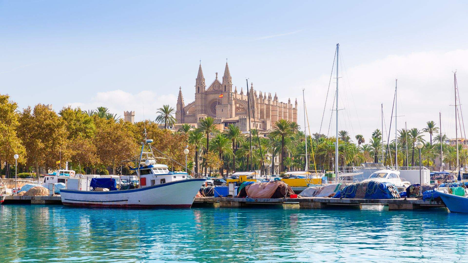
The week starts in Palma. Fifteen minutes by road from PMI airport, the city's three main yacht facilities — Marina Port de Mallorca, Real Club Náutico de Palma, and STP — sit along the western arc of Palma Bay under the Cathedral La Seu. Your crew meets you at the slip with cold drinks and the chart briefing. The galley is already stocked, the steward settles your luggage into cabins, and the chef walks you through the welcome plate while the captain readies the boat to leave.

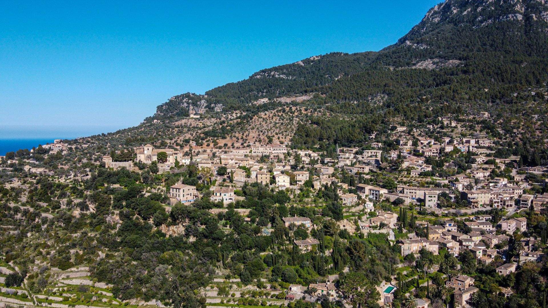
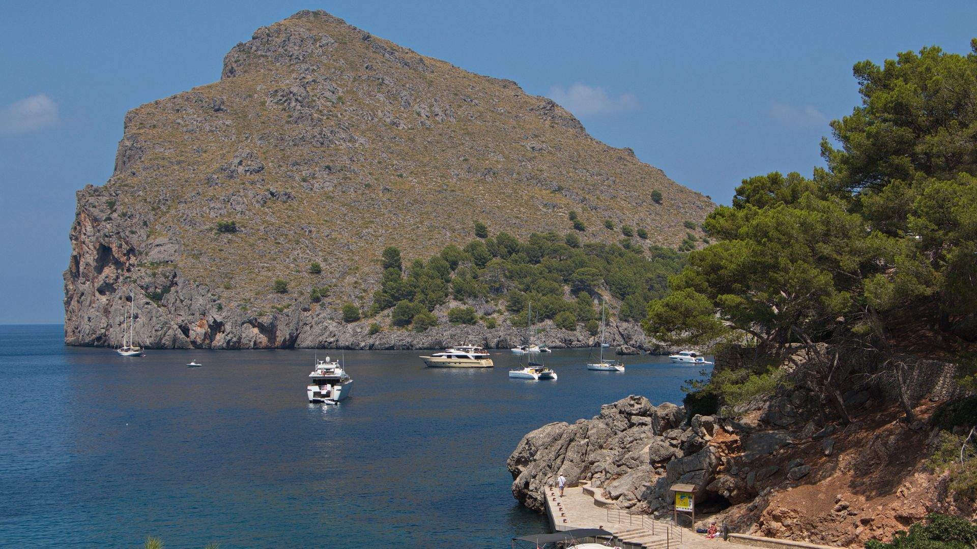
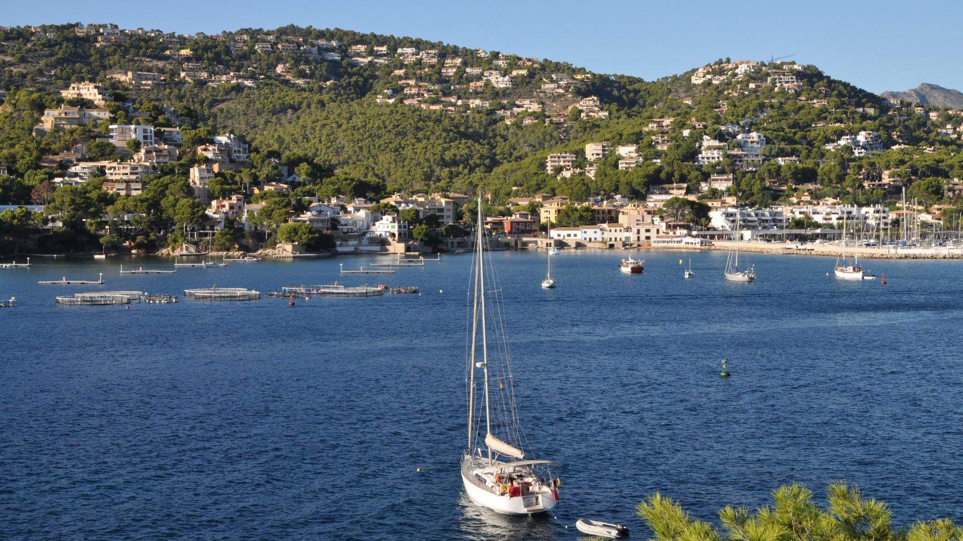
By late afternoon the captain is slipping lines. A twenty-two-nautical-mile run west around the headland past Magaluf and Santa Ponsa to Port d'Andratx — the working fishing harbor at the western tip of Mallorca, the staging port for any Tramuntana week. The anchorage in front of the harbor sits in 8 to 15 meters of sand; the captain anchors offshore or picks up a stern-to mooring inside the harbor depending on availability. Tender ashore for dinner — the quay-side restaurants along the Andratx waterfront run from working sailors' grills to the gastronomy of Restaurante Layn at the end of the breakwater. The first night is the captain's call; the rhythm of the week starts here.

Day Highlights

  • Embarkation at Palma — fifteen minutes from PMI airport.
  • Twenty-two-nautical-mile evening run west to Port d'Andratx.
  • Anchored or stern-to in Mallorca's working fishing harbor.
  • First night dinner ashore at the Andratx quay.
2

Day 2 of 7 · Port d'Andratx → Sa Dragonera → Sa Foradada

Sa Dragonera Reserve and the Tramuntana Cliff Coast

Anchorage: Sa Foradada cove
The pierced-rock peninsula on Mallorca's northwest coast — anchored below, the rock frames the cove like a portal.

A morning's reach west to Sa Dragonera, the uninhabited islet that's been a Natural Park . Visitor cap on the island is ~150 at a time; charter yacht parties tender ashore at the official dock at Cala Lladó for a walk to Far de Llebeig — the SW lighthouse, on a four-kilometer round-trip path — or just a swim in the strait between the islet and Mallorca's coast. Sa Dragonera takes its name from the silhouette: from the mainland the islet looks like a sleeping dragon along the horizon.

By midafternoon the captain points the bow north along the Tramuntana coast — twenty-five nautical miles of granite-and-limestone cliffs falling six hundred meters into the water under Puig Major. The cliffs are the protected mountain coast; the cruising-coast view of them is the half of Mallorca most visitors don't get to see. Sa Foradada sits roughly halfway up — the L-shaped peninsula with its famous through-hole near the tip, the open paella restaurant on the cliff above (operational status varies — verify with your captain before counting on the day-of dinner ashore), reachable by tender from the cove or by a forty-five-minute hike up to the Ma-10 coast road. Anchor in the cove, swim under the through-hole, dinner ashore or on board depending on what the captain finds open.

Day Highlights

  • Morning at Sa Dragonera Natural Park — tender ashore at Cala Lladó, walk to Far de Llebeig.
  • Twenty-five-nautical-mile afternoon along the Tramuntana cliff coast.
  • Anchor in Sa Foradada cove — the iconic through-holed peninsula.
  • Tender or hike to the cliff above; swim under the famous through-hole.
3

Day 3 of 7 · Sa Foradada → Port de Sóller (via Cala Deià)

Cala Deià at Lunchtime, Sóller for the Night

Anchorage: Port de Sóller (the only natural harbor on the Tramuntana)
A cliff-top fish restaurant above a cove the road can't reach. The day's catch comes up from the family boat moored below, the table set on the cliff above.

A short run north and east to Cala Deià, the rocky cove below the village of Deià where Robert Graves lived and the literary expat circle of the 1960s settled. Anchor in the cove (the captain reads the swell — the cove is exposed to NW so on settled days only); tender ashore for lunch at Ca's Patró March, the cliff-top restaurant the same family has run for three generations. Fish of the day comes up directly from the catch boat moored below; the tables sit at the cliff-edge under awnings; the captain books the table the morning of arrival.

By midafternoon the captain repositions the yacht ten nautical miles north into Port de Sóller — the only natural harbor on the entire Tramuntana coast, 605 berths, the Tren de Sóller wooden train running up to the village square through the orange groves . Stern-to in the marina or anchored in the outer bay. Sóller's town square hasn't changed character since the 1920s; dinner is at one of the quay-side restaurants or up in the village. The town is the operational base for the entire Tramuntana week; the captain refuels and re-provisions if needed before the next day's run north.

Day Highlights

  • Anchor at Cala Deià, tender to Ca's Patró March for cliff-top lunch.
  • Fish from the family catch boat — three-generation kitchen on the cliff.
  • Reposition fifteen nautical miles to Port de Sóller for the night.
  • Sóller — only natural harbor on the Tramuntana, 605 berths, the historic wooden train to the village.
4

Day 4 of 7 · Port de Sóller → Sa Calobra → Cala Tuent

Under Puig Major — The Torrent de Pareis Day

Anchorage: Cala Tuent
A stone-and-sand cove at the base of Mallorca's tallest mountain. The cliff walls rise straight from the water on both sides of the cove.

A twelve-nautical-mile run east-northeast under the highest stretch of the Tramuntana — Puig Major's 1,445-meter summit (closed military zone) and Puig de Massanella's 1,364-meter accessible peak both rising directly off the bow. Sa Calobra sits at the foot of the cliffs — the stone-and-sand cove where the Torrent de Pareis ravine debouches into the sea. The ravine is a Spanish Natural Monument designated 2003, three kilometers of limestone slot through the Tramuntana, hiked in from the beach (scrambling and sometimes wading) for guests who want it.

By midafternoon the captain repositions a short hop west into Cala Tuent — the quieter sister cove on the other side of the Morro de sa Vaca headland, sheltered from the NW swell, deeper water for anchoring (8 to 11 meters on a rock-and-sand bottom). Cala Tuent has a small chapel above the cove (Ermita de Sant Llorenç, founded 1230) reachable on a half-hour walk from the beach. Dinner is on board — there's no taverna on Cala Tuent, no quay, no village — just the cove and the cliffs and whatever the chef has put together from the morning's market stop in Sóller.

Day Highlights

  • Twelve-nautical-mile run under Puig Major's 1,445-meter granite.
  • Sa Calobra — Spanish Natural Monument, the Torrent de Pareis ravine debouches at the cove.
  • Hike or scramble up the slot canyon from the beach (settled weather only).
  • Reposition to Cala Tuent — sheltered, quieter, chapel walk above the cove.
  • Dinner aboard at anchor — no taverna, just the cliffs and the chef.
5

Day 5 of 7 · Cala Tuent → Cap Formentor → Pollensa

Cap Formentor — Mallorca's Northernmost Point

Anchorage: Pollença Bay (Cala Figuera)
Mallorca's mountain coast from below — granite and limestone falling straight to the water along the island's northwest face.

A thirty-nautical-mile run east along the Tramuntana coast to Cap Formentor — the northernmost point of Mallorca, the lighthouse built in 1863, the eastern terminus of the Sierra de Tramuntana. The cape projects into the open Mediterranean like a knife; the cruising-water view of the cliffs from below is genuinely different from the famous overlook road view from above. The captain reads conditions before committing — Cap Formentor takes the full force of any northerly weather, and the lee side at Cala Figuera (the small protected cove on the SW face) is the standard overnight in any condition that isn't dead-calm.

Cala Figuera below the cape is a deep, dramatic cliff-rimmed anchorage in 15 to 30 meters of water — the kind of bay where the yacht swings on a long scope and the swimming is straight off the swim platform into very deep blue. Overnight here on settled days; alternatively the captain runs another six nautical miles into Pollença Bay for the larger sheltered anchorage at Puerto de Pollensa, with quay-side restaurants in the town and an easier early-morning departure for the next day's southern run.

Day Highlights

  • Thirty-nautical-mile coastal run east along the Tramuntana.
  • Cap Formentor — Mallorca's northernmost point, lighthouse 1863, NE terminus of the range.
  • Cliff-rimmed anchorage at Cala Figuera in 15–30m of water.
  • Pollença Bay alternative for sheltered overnight and quay-side dining.
6

Day 6 of 7 · Pollensa → Cabrera

The Long Run South — Cabrera Permit Anchorage

Anchorage: Cabrera National Park (permit anchorage)
The natural harbor at Cabrera National Park. A medieval watchtower stands on the eastern headland, a short walk up from the dock.

The longest day of the week. A fifty-five-nautical-mile run south down Mallorca's east coast — the captain reads the morning wind and decides whether to round the coast inside or jump offshore. Cabrera National Park sits seven nautical miles south of Mallorca's south coast; the permit anchorage opens at 18:00 on the day of arrival and the captain has booked the buoy twenty days in advance through https://www.caib.es/rescabfront/. The reservation system caps fifty boats per day across the three mooring fields at Port de Cabrera, Es Burrí, and Sa Coveta Roja, and the park enforces a limited charter quota when oversubscribed — peak July/August Saturdays carry a twenty-boat waitlist in practice.

The afternoon at Cabrera is the marquee yacht-only-access moment of the week. Tender ashore to the dock at the harbor, then a short walk up to the medieval watchtower on the eastern headland — free, self-guided, climbed for the panoramic view. Swim in the harbor basin in water that looks like the Mediterranean did fifty years ago. Dinner is on board at anchor. The island has no shops, no fuel, no restaurants. Cabrera's silhouette under stars is the kind of view that stays with people.

Day Highlights

  • Fifty-five-nautical-mile run south down Mallorca's east coast.
  • Cabrera permit anchorage — fifty boats/day across three mooring fields; ≤35m yacht cap.
  • Tender ashore to the castle on the eastern headland.
  • Swim in Port de Cabrera — the basin looks like the Mediterranean did fifty years ago.
  • Dinner aboard at anchor — no on-island services.
7

Day 7 of 7 · Cabrera → Cova Blava → Palma

Cova Blava and the Run Home

Anchorage: Palma (disembarkation)
A forty-meter sea-cave on Cabrera's west coast, reachable only by tender. Mid-morning light fills the cave with shafts of electric blue.

An early start. The captain pulls off the buoy before breakfast and runs the tender or repositions the mother yacht three nautical miles north to the Cova Blava — the forty-meter sea-cave on Cabrera's west coast, the visual money shot of any Balearic charter. The cave entrance is six meters high; inside the natural arch climbs to twenty meters and the noon-hour light comes in through the opening to turn the water electric blue. Visit windows run typically before 11:00 to beat the commercial day-boat surge from Colònia de Sant Jordi.

By midmorning the captain points the bow north for the forty-five-nautical-mile run back to Palma. The afternoon is the long, slow re-entry into the bay — the Cathedral La Seu growing from the horizon, the marina taking the boat back at the slip mid-afternoon. Disembarkation is typically 09:00 Saturday morning, but guests who want one more night on board can extend at anchor in Palma Bay, with the captain returning the boat to the marina the morning of departure. The week ends with the chef's last plate and a final aft-deck sundowner on Mallorca's southern bay.

Day Highlights

  • Early-morning Cova Blava — forty-meter sea-cave, tender entry, swim inside.
  • Forty-five-nautical-mile run north back to Palma.
  • Re-entry into Palma Bay — Cathedral La Seu from the water.
  • Disembarkation Saturday morning at Marina Port de Mallorca or Real Club Náutico.

Frequently asked

How long is a typical Mallorca / Tramuntana itinerary?
Seven days is standard — the right number to do Port d'Andratx, Sa Dragonera, the Tramuntana cliff anchorages, Cap Formentor, and Cabrera National Park without rushing. Ten-day variants extend to Menorca (Cala Galdana, Mahón) on the east end before returning. Five-day Mallorca charters work but mean cutting either Cabrera or the Cap Formentor leg.
When's the best time of year for a Mallorca charter?
Late May through June and September into early October are the strongest weeks — water at 70–78°F, daytime highs in the low 80s, the Embat thermal sea breeze setting in reliably by lunch, Cabrera permits clearing easier. July and August are peak heat and peak demand — sea at 80°F, daytime highs 86–90°F, Marina Ibiza and Real Club Náutico de Palma berths six to nine months in advance for premium yachts. Cabrera permits sell out in minutes for July/August Saturdays.
Sailing yacht, catamaran, or motor yacht?
Any of the three work the Tramuntana — Sa Calobra, Cala Tuent, and Sa Foradada all anchor cleanly on a rock-and-sand bottom in 8 to 15 meters of depth. Sailing yachts and modern catamarans handle the Embat thermal sea breeze well; motor yachts cover the longer Tramuntana legs in less time. The main consideration is Cabrera National Park: hull length capped at thirty-five meters. Above 35m the captain substitutes Mondragó or Cala Figuera for the south-Mallorca night and visits Cova Blava by tender from a nearby anchorage. We walk through which yacht fits before you book.
What about Cabrera National Park — can we guarantee the stop?
Cabrera permits open exactly twenty days in advance and high-demand Saturdays in July and August fill within minutes; there's a fixed limited charter quota when oversubscribed. The captain books the buoy as part of standard charter preparation, but the day-to-day is subject to permit availability. The week is built so that if Cabrera doesn't clear for your specific date, the south-Mallorca night substitutes Mondragó or Cala Figuera and the Cova Blava sea-cave is reached by tender from a nearby anchorage outside the permit zone.

Ready to set sail in the Balearic Islands?

Every itinerary we send is custom-tailored. Tell us your dates, the size of your group, and what you want out of your charter—we'll handle the rest.