INDULGE II
90FT · MOTOR YACHT
15 reviews
Pricing from $42,000/week
10 Guests · 4 Cabins · 4 Crew
Caribbean
Eastern Mediterranean
Western Mediterranean
South Pacific
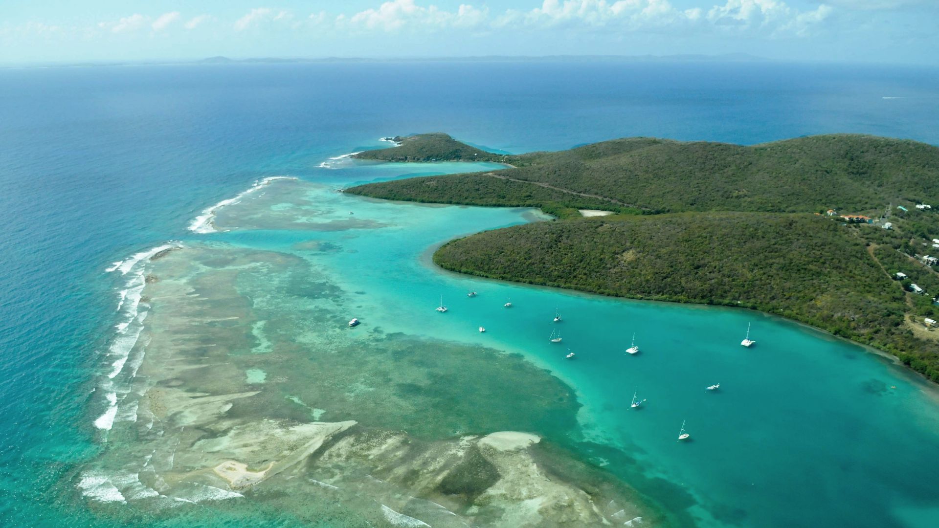
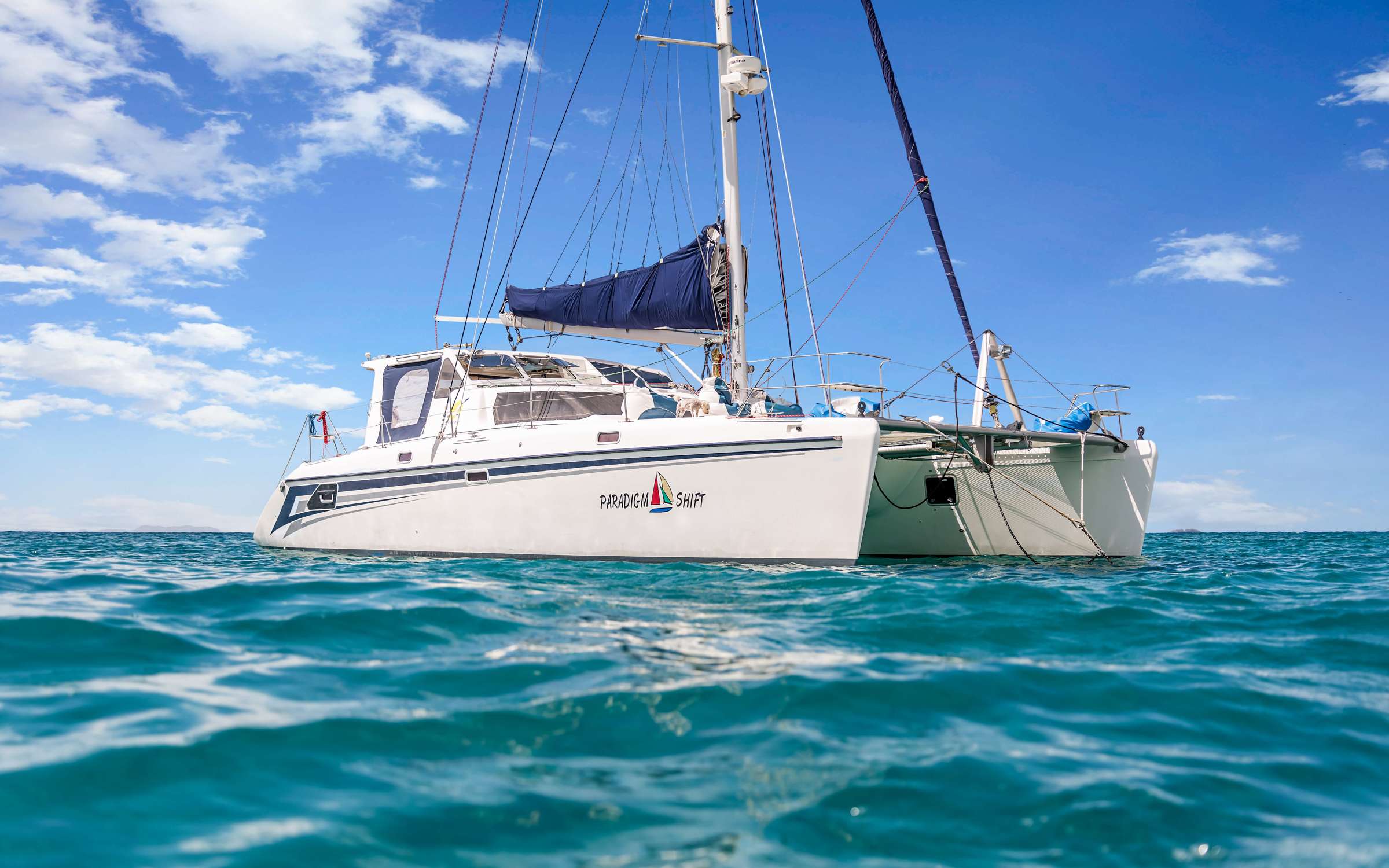
Crewed catamaran charters through Vieques, Culebra, and Culebrita — empty anchorages and US-territory access from Puerto Rico or St. Thomas.
Why the Spanish Virgin Islands
The Spanish Virgin Islands sit between the US Virgin Islands and Puerto Rico — two main islands, Vieques and Culebra, with a scatter of uninhabited cays around them. Both fly the US flag under Puerto Rico, which keeps the trip simple for US guests: no passport, no foreign-country customs clearance the way a BVI or Bahamas charter requires. The reason most charter guests have never heard of the chain is logistical, not legal — there is no direct international flight into either island, and the cruising ground sits just outside the BVI/USVI charter loop most of the industry runs.
A crewed yacht is the only practical way to see them, and the boats that work the route are not a permanent fleet. No charter yachts live in the Spanish Virgin Islands; the inventory is BVI- and USVI-based catamarans and sailing yachts that come over for the trip. Inventory is thinner than the more-trafficked grounds and lead time matters, but the captains who run the loop know it well, and they handle the one piece of routing that actually requires local knowledge: the prevailing east-northeast trades put the run downwind from St. Thomas through Vieques and Culebra, and the upwind beat back across the channel on the last day. A captain who's worked the loop calls the timing of the upwind day around the morning's forecast.
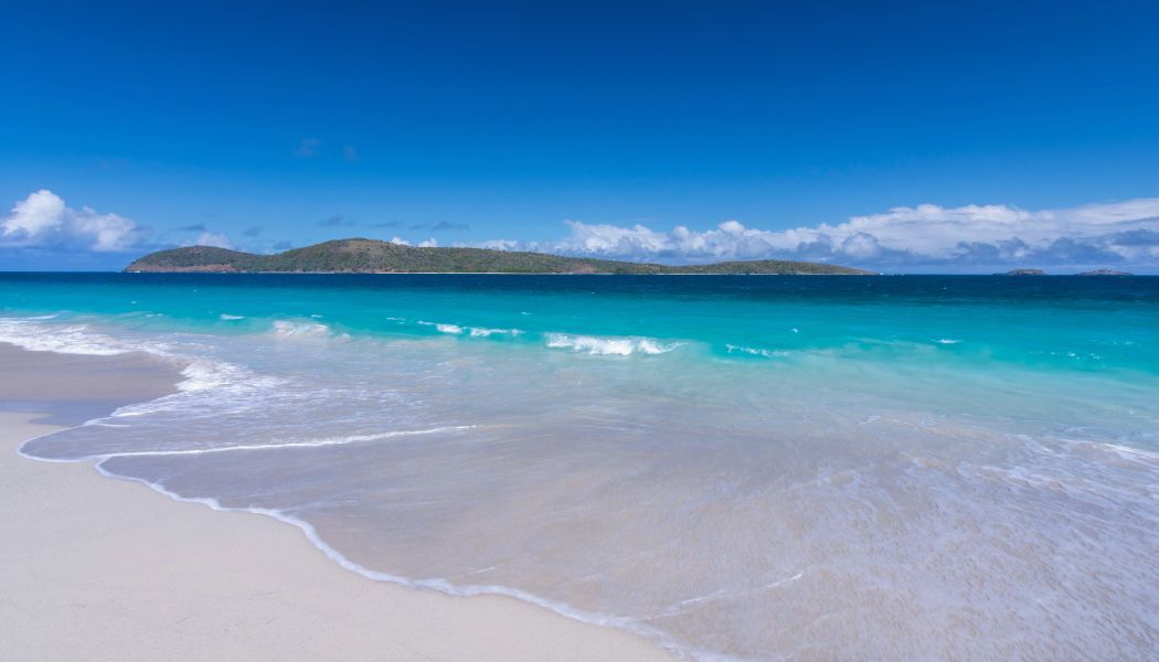
What sets the chain apart from the better-known Caribbean charter grounds is the absence of crowds. Locals describe the Spanish Virgin Islands as what the BVI used to be thirty years ago, and the description holds up. Carlos Rosario on Culebra's northwest corner is one of the densest stands of elkhorn coral in the Caribbean, protected as a marine reserve since 1999. Bahía Mosquito on Vieques is the brightest bioluminescent bay in the world by Guinness measurement. Culebrita's Faro — a 19th-century Spanish Crown lighthouse decommissioned in 1975 — sits as a hilltop ruin with 360-degree views over the entire chain. Few cruising grounds in US waters offer this much variety with this little charter traffic.
Four characteristics that distinguish the SVI from the more-trafficked Caribbean charter grounds.
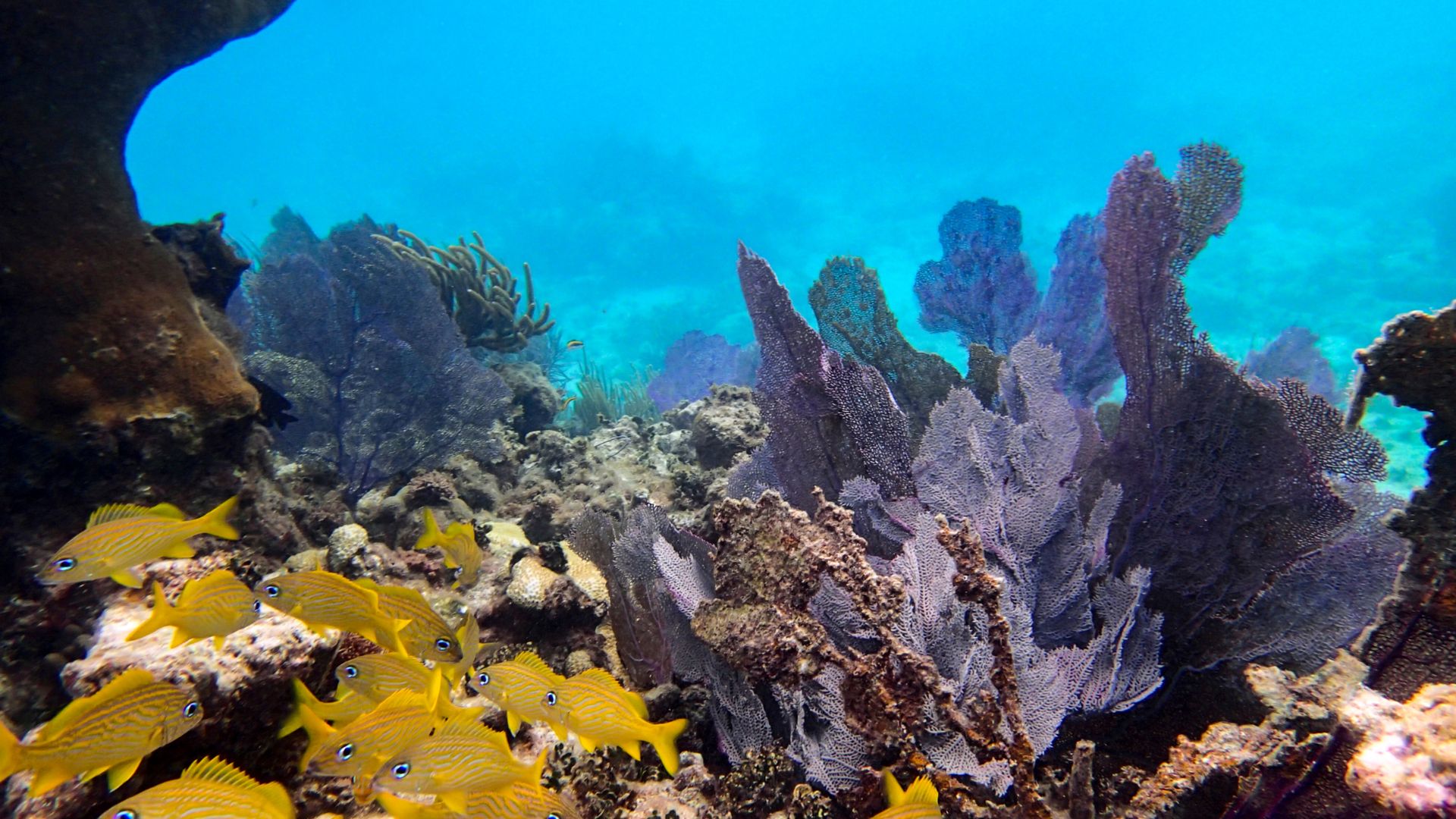
Carlos Rosario on Culebra's northwest corner is one of the densest stands of elkhorn coral in the Caribbean — protected as a marine reserve since 1999, and recovered to the point where it's genuinely one of the best snorkel sites in US waters. The reef at Ensenada Dakity, tucked behind a barrier on Culebra's south coast, runs sixty to eighty feet of visibility on a settled trade-wind day. Both sites stay quiet because almost no charter traffic moves between Vieques and Culebra.
Most cays in the chain are uninhabited. Cayo Luis Peña and Culebrita are protected wildlife refuges with no permanent residents, no docks, and no facilities — half-mile islands ringed by reef where the boat sits on its hook for an afternoon and you might be the only yacht in sight. The contrast with the higher-traffic BVI just upwind is immediate.

Vieques's Bahía Mosquito is the brightest bioluminescent bay in the world by Guinness measurement — every paddle stroke at night lights up the surface electric blue. The bathymetry south of Vieques falls off from forty feet to several thousand within a couple of miles, and the deep-water edge — known locally as "the drop" — is one of the most reliable offshore-fishing spots in the eastern Caribbean. Mahi peak in winter; tuna stay steady year-round.
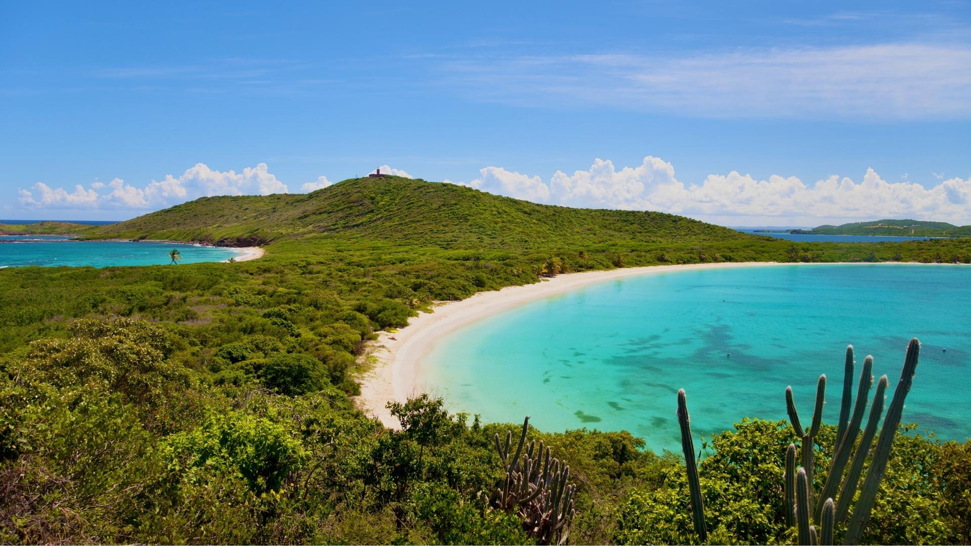
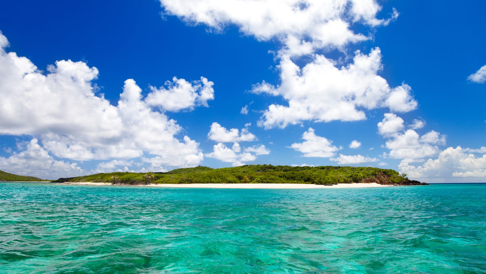
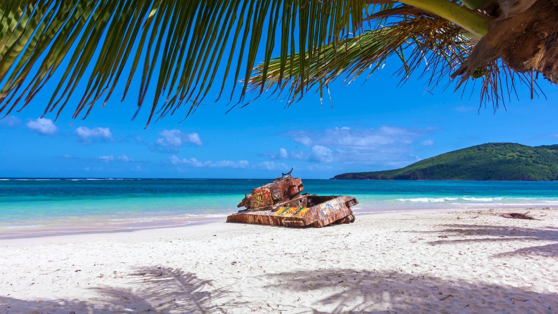
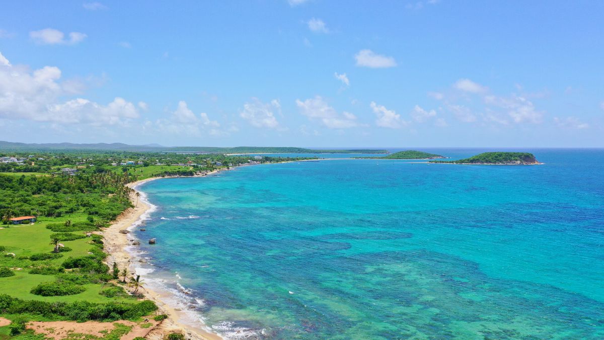
Playa Flamenco on Culebra has been ranked among the world's top ten beaches by Travel + Leisure, Discovery Channel, and the Travel Channel — a horseshoe of fine white sand with two rusted Sherman tanks at the east end, the legacy of the US Navy bombing-range era that ended in 1975. Playa Tortuga on uninhabited Culebrita has resident green sea turtles year-round and a 1880s Spanish-Crown lighthouse on the hill above it. Sun Bay on Vieques's south coast closes the loop with a working-island feel a short tender ride from the village of Esperanza.
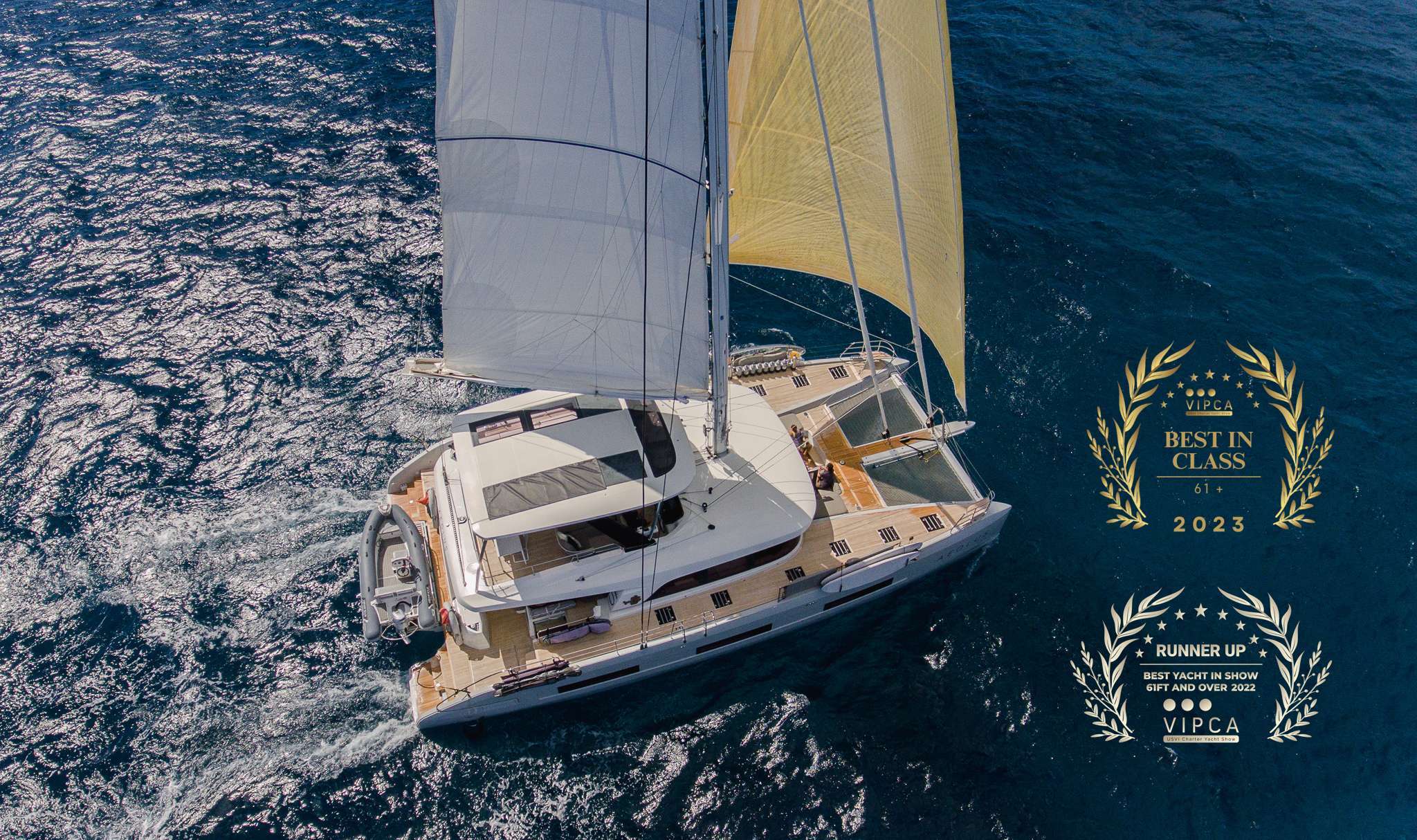
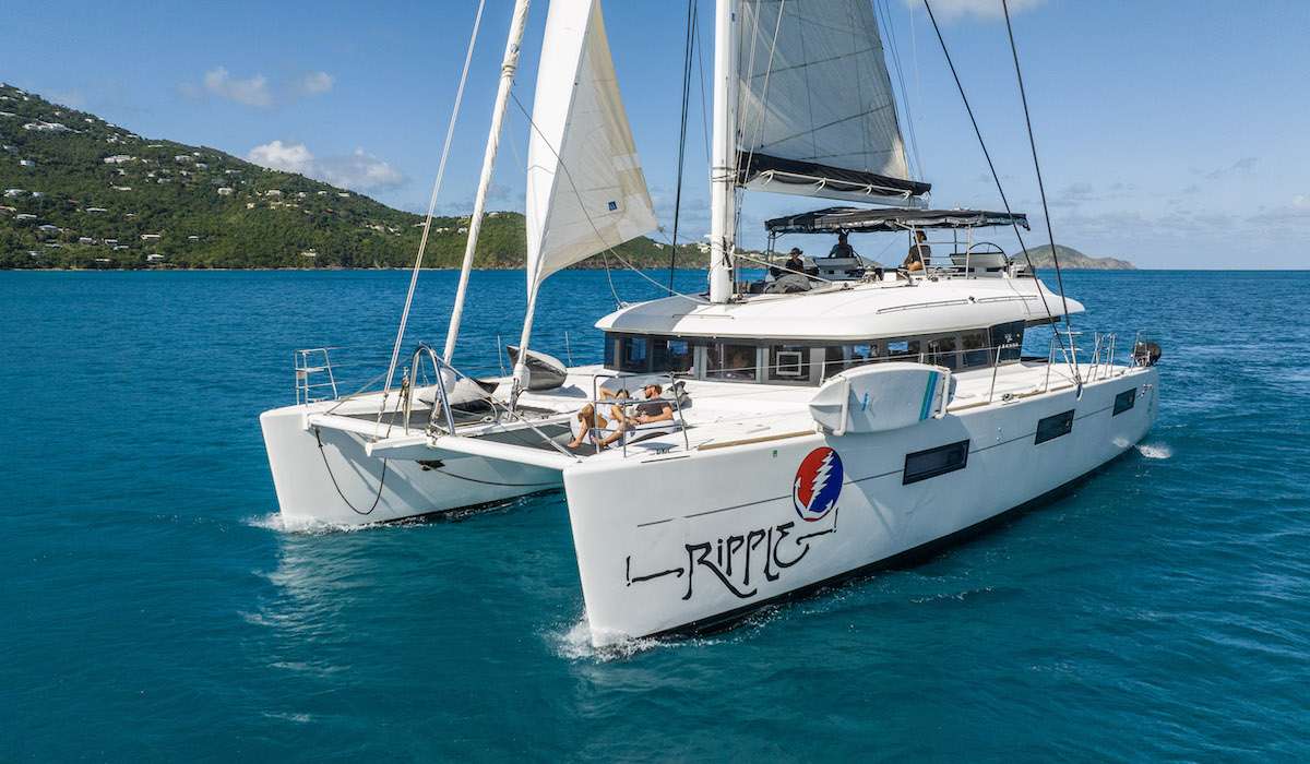
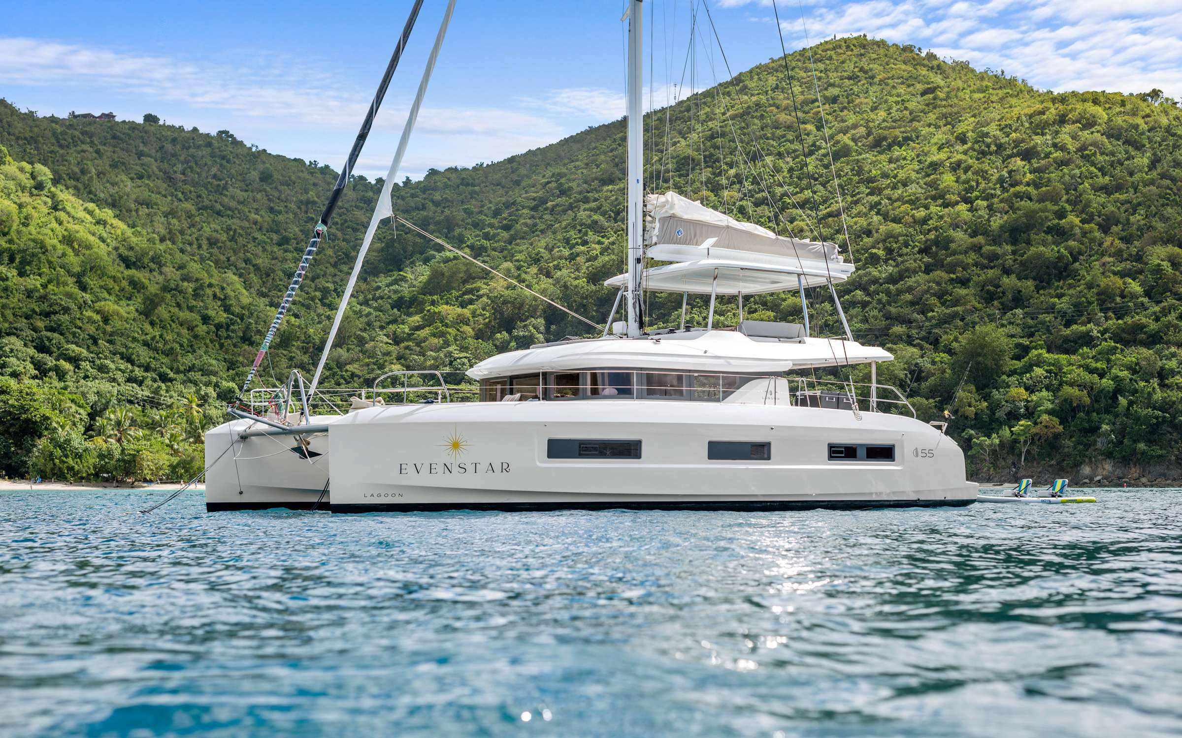
A hand-picked selection of crewed charter yachts for Spanish Virgin Islands — yachts and crews we know firsthand.
Your week is shaped around your group's interests, the season, and the conditions on the water — your captain tailors the days as they unfold. Treat this itinerary as a starting point for inspiration.
Crewed Itinerary · Spanish Virgin Islands
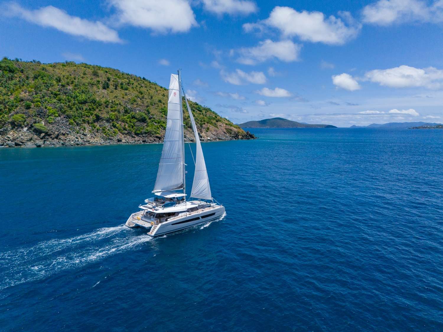
The Spanish Virgin Islands sit between the US Virgin Islands and Puerto Rico—two main islands, Vieques and Culebra, with a scatter of uninhabited cays around them. They're the same chain that produces the BVI's anchorages and the USVI's beaches, but with a fraction of the charter traffic, no passport requirement, and the kind of empty bays that the BVI used to have thirty years ago. The reason most charter guests have never heard of them is logistical: there's no direct international airport into either island, and the standard charter base has historically been Puerto del Rey on the Puerto Rico mainland, which adds a long airport-to-marina day on either end of the trip. The fix is to start the charter where the boats actually live—St. Thomas—and run the route as a downwind clockwise loop. That's the itinerary below.
Seven days, roughly 95 nautical miles, downwind sailing for the first half and an upwind return on the last day. Two nights in Vieques (south coast and west coast), four in Culebra and Culebrita, one final night back across the channel at Magens Bay on St. Thomas. Both Vieques and Culebra are US territory—same as the USVI—so there's no customs paperwork, no passport stamp, and no clearance window to plan around. With your professional captain and private chef running the boat, you step aboard at Yacht Haven Grande, point the bow west, and let the trades do the rest.
The Spanish Virgin Islands deliver everything guests come to the BVI for — clear water, empty beaches, downwind trade-wind sailing — without the passport, the Customs paperwork, or the crowds. Vieques and Culebra are US territory, the same as the USVI; you fly into STT and step aboard. The Bahía de la Chiva (Blue Beach) anchorage on Vieques and the Flamenco/Culebrita arc on Culebra are arguably the best beach anchorages anywhere in the US Caribbean.
About 95 nautical miles across the week — downwind on the way out (St. Thomas to Vieques to Culebra), an easy upwind return on the last day. The route is built as a clockwise loop so the boat is always pointed the right way for the trades. If you've sailed the BVI and want something quieter without the passport hassle, the Spanish Virgin Islands are the sleeper Caribbean charter.
Day 1 of 7 · St. Thomas → Vieques south
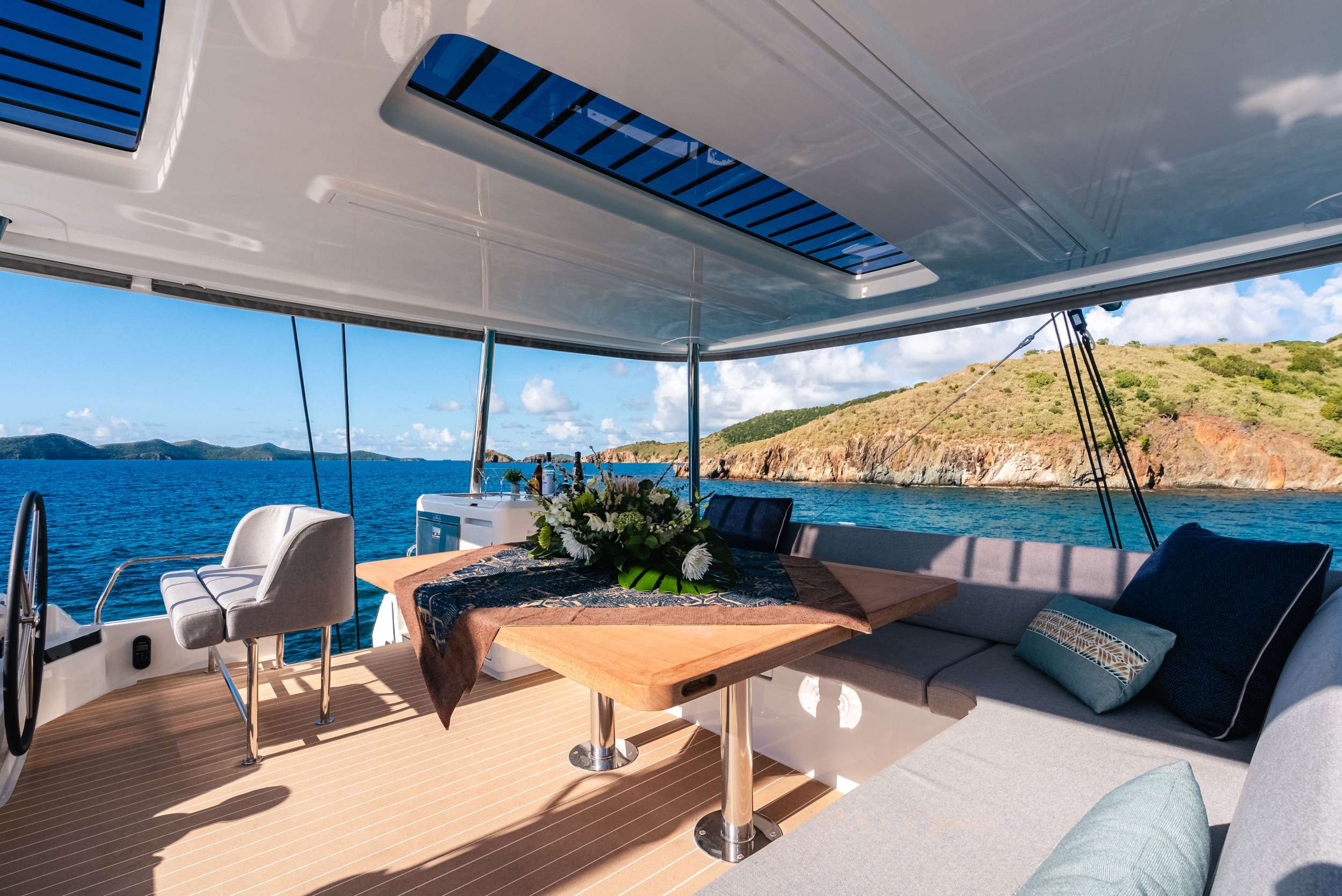
Your week begins at Yacht Haven Grande on St. Thomas, the largest and best-run megayacht marina in the eastern Caribbean. Your professional crew meets you at the slip with cold drinks and a chart briefing that frames the route ahead, walks you through the boat, and gets your gear stowed while the chef finishes provisioning. Because both the US Virgin Islands and Puerto Rico are US territory, there's no customs paperwork, no passport clearance window, and no morning lost to an immigration office. You step aboard, sign the charter agreement, and the boat is moving by lunch.
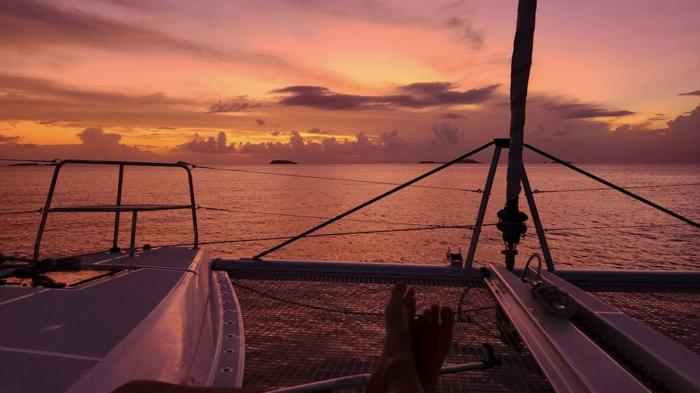
By early afternoon, lines off for the thirty-nautical-mile downwind reach west to Vieques. The trades blow steady east-northeast through the high season at fifteen to twenty knots, which puts the wind dead astern for most of the leg—a fast, dry sail with the boat surfing down the swell, St. Thomas dropping behind the transom, and the long flat profile of Vieques growing on the bow. By late afternoon you're tucked into Bahía de la Chiva—Blue Beach to the locals—on the south coast of Vieques, with Isla Chiva blocking the breeze and a quarter-mile of palm-lined white sand off the bow.
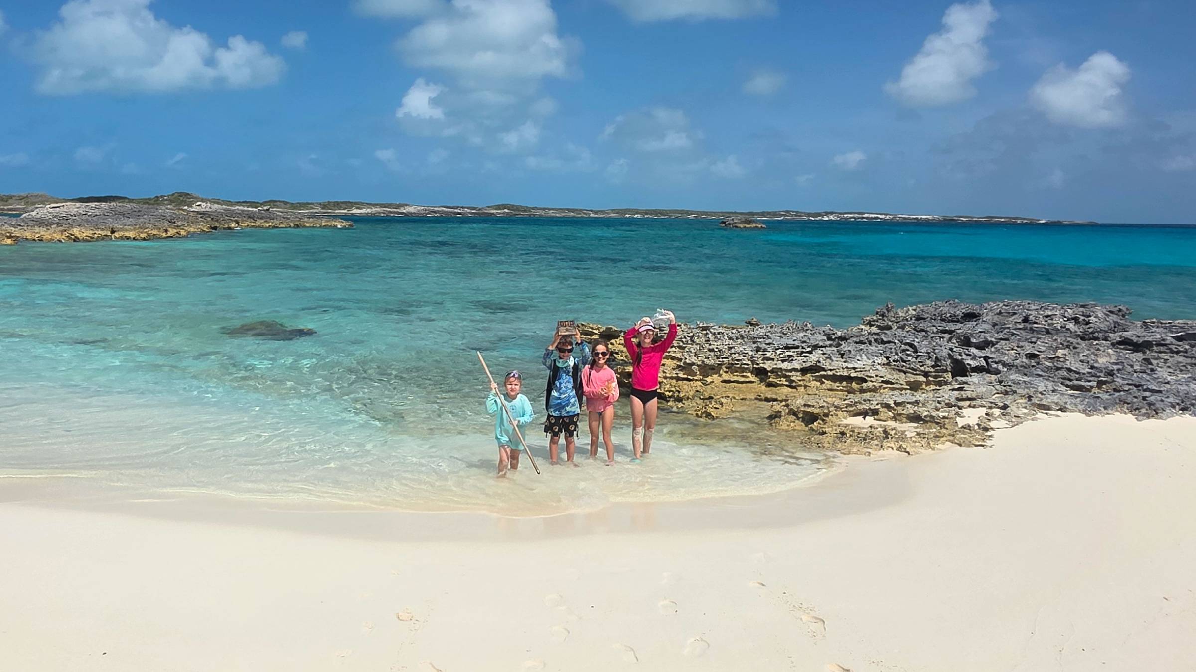
The first afternoon is deliberately slow. Swim off the back of the boat, paddleboard into the beach, walk the sand. Vieques is famously home to a population of free-roaming wild horses—descendants of the Spanish colonial herds—and you'll often see them grazing along the beach line at dusk. Chef-prepared welcome dinner aboard tonight, the lights of Esperanza glowing seven miles west across the bay.
Optional evening tour: Mosquito Bay bioluminescence. Vieques's Bahía Mosquito is the brightest bioluminescent bay in the world by Guinness measurement—the dinoflagellates glow electric blue when disturbed, which means every paddle stroke, every fish swimming under your kayak, every hand dragged through the water lights up the surface. Anchoring inside the bay is prohibited (it's a protected reserve), so the tour is by guided kayak from Esperanza, run after full dark on dark-moon nights only. Your captain books the tour and arranges the transfer if the lunar window cooperates. Skip it on full-moon weeks—the bay still glows, but you can't see it under the moonlight.
Day Highlights
Day 2 of 7 · Vieques south → west
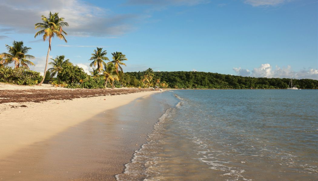
After a slow morning swim off the back of the boat, your captain repositions five miles west to Sun Bay—a long crescent of public beach just east of Esperanza, with sandy holding and shelter from the trades. Anchor in the bay, then tender ashore for lunch in town. Esperanza is the south-coast village—a handful of streets clustered around a half-mile waterfront promenade called the malecón, with a half-dozen open-air seafood places lined up facing the water. Bili and Duffy's are the casual lunch picks; El Quenepo is the upscale Caribbean-fusion option if you'd rather a longer lunch and a bottle of wine.
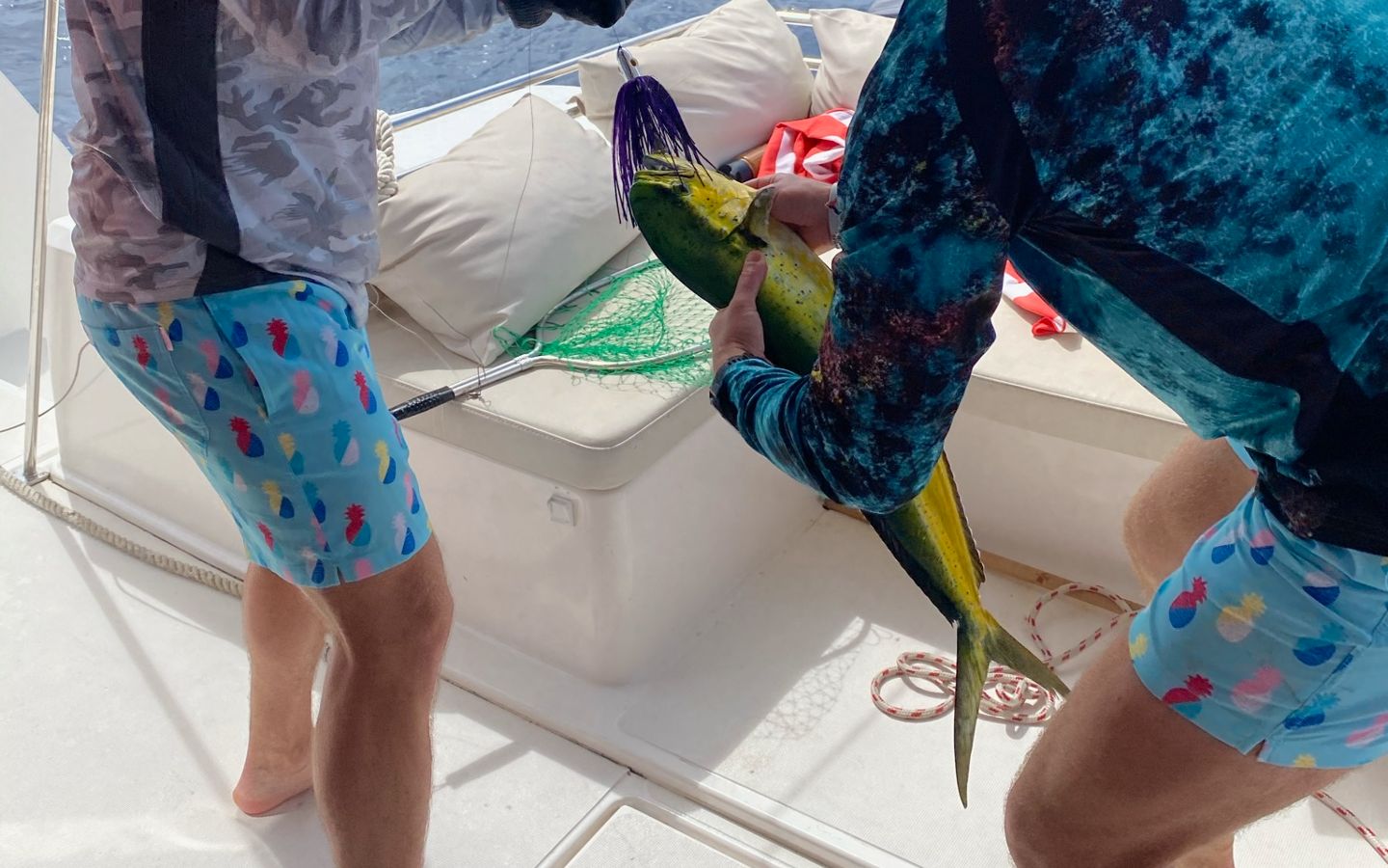
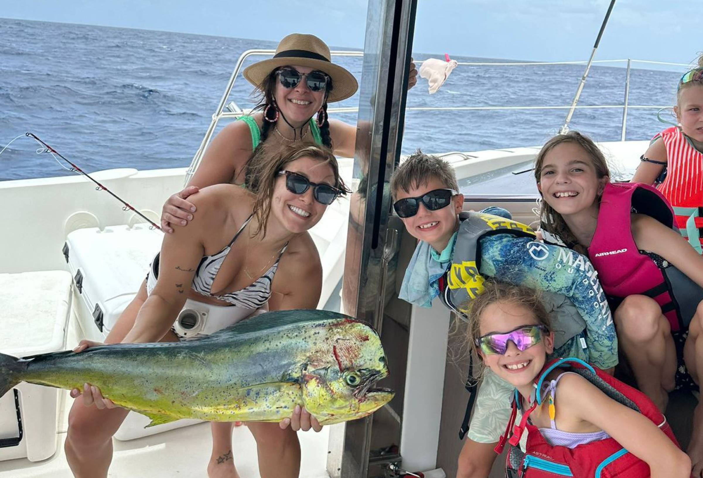
Back aboard by mid-afternoon, lines off for the longer leg of the day—a downwind run south along Vieques's coast, around the west tip, and up to Green Beach on the west side. The route passes over the underwater shelf known locally as "the drop"—the bottom falls off from forty feet to several thousand within a couple of miles—and the deep-water edge is one of the most reliable offshore-fishing spots in the eastern Caribbean. Mahi, wahoo, blackfin tuna, and the occasional white marlin work the drop year-round, with mahi peaking in winter and tuna staying steady. If you have anglers aboard, your captain rigs trolling lines as you pass through.
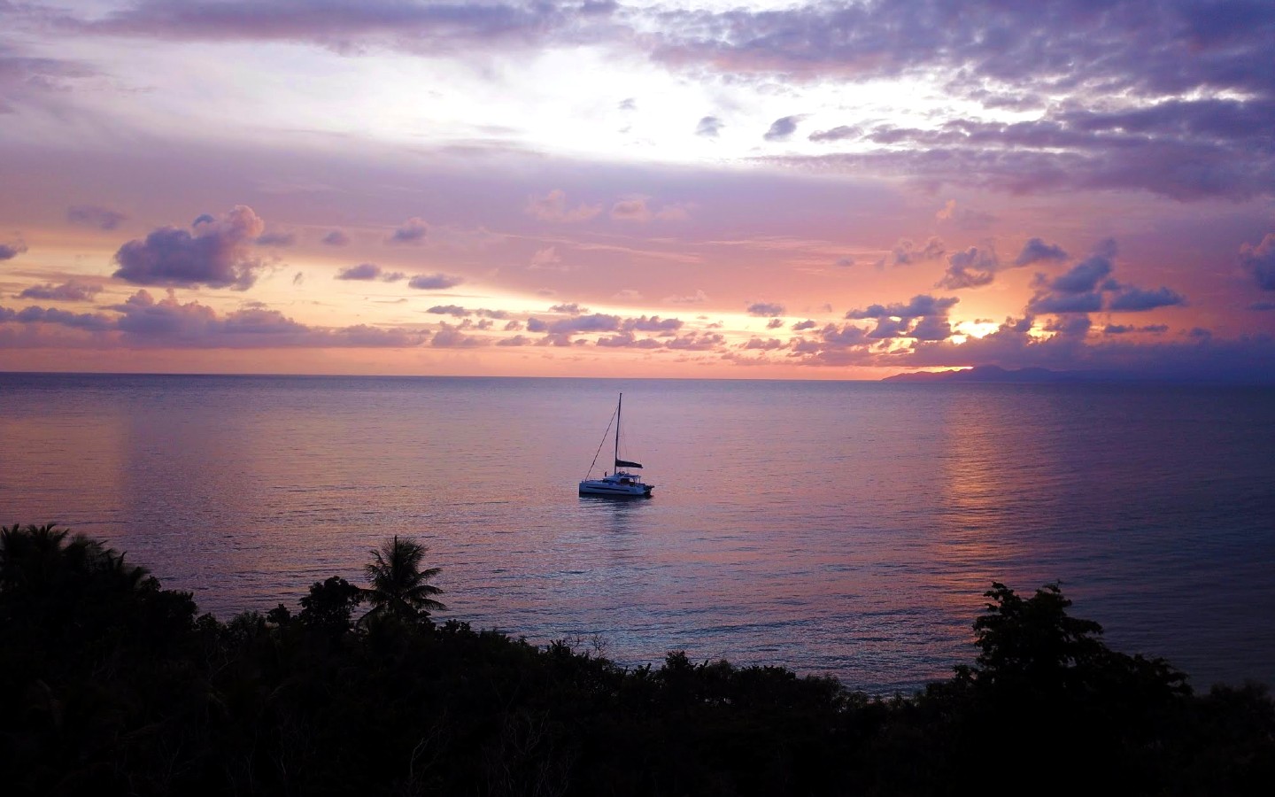
Late afternoon, your crew brings the boat around the western tip of Vieques and into Green Beach—a long, mostly empty stretch of sand on land that was US Navy property (Camp Garcia) until the bombing range closed in 2003. The west-facing aspect makes for the best sunset on the route: the silhouette of the Puerto Rico mainland seven miles across the channel, El Yunque rainforest darkening to the north, the sky going through every shade of pink and orange. Dinner aboard tonight, anchored alone or with one or two other yachts in a bay that almost no charter actually visits.
Day Highlights
Day 3 of 7 · Vieques → Culebra
After breakfast aboard at Green Beach, your captain points the bow north for the twelve-mile crossing of Vieques Passage to Cayo Luis Peña. The morning trades come in across the beam, and the boat reaches comfortably across the open water with Vieques receding behind and the low profile of Culebra and its outlying cays building on the horizon. The passage itself is uncrowded—almost no charter traffic moves between Vieques and Culebra, which is part of why this stretch of the chain feels twenty years behind everything else in the Caribbean.
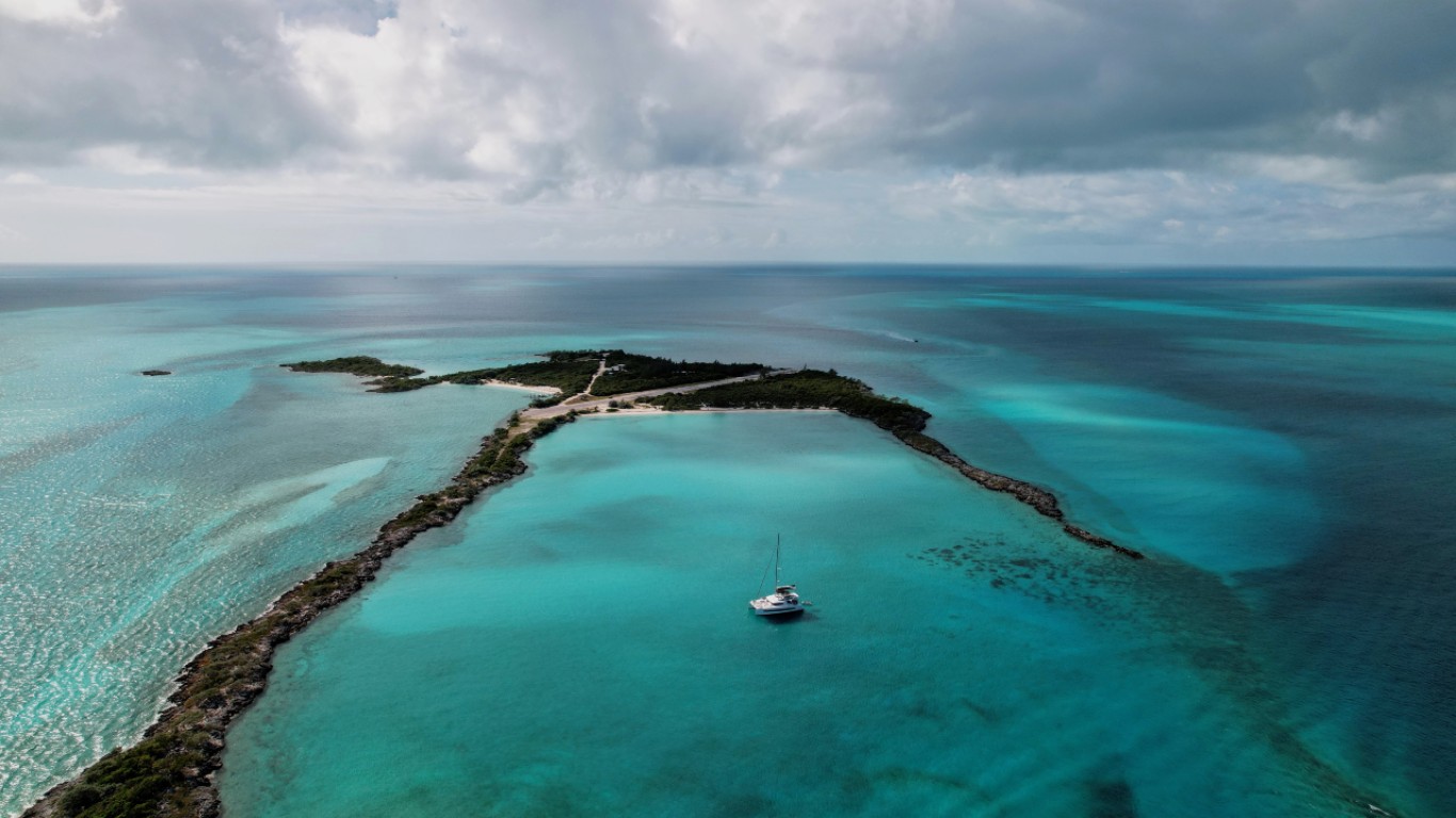
Cayo Luis Peña is a small uninhabited cay sitting a half-mile west of Culebra proper, ringed by reef and protected as part of the Culebra National Wildlife Refuge. Anchor in the lee for an hour or two—long lunch on the hook, a swim off the back, an exploratory tender ride into the small white-sand beach on the south side of the cay. The reef holds a remarkable amount of fish life for being so close to a working anchorage, and the snorkel off the bow rewards a slow drift along the edge.
Mid-afternoon, a short three-mile hop east brings you into the Carlos Rosario anchorage on the northwest corner of Culebra. Carlos Rosario is one of the densest stands of elkhorn coral in the Caribbean—the staghorn-coral reef has been protected as a marine reserve since 1999, and it's recovered to the point where it's now genuinely one of the best snorkel sites in US waters. Your crew drops the dinghy and takes you in for a late-afternoon snorkel before the wind drops. Sunset over the western cays from the anchorage is the closing shot of the day. Dinner aboard, the boat sitting on its hook with the cays going dark to the west.
Day Highlights
Day 4 of 7 · Beach day at Flamenco
Today is the beach day, and Playa Flamenco earns it. Travel + Leisure, Discovery Channel, and the Travel Channel have all ranked it among the world's top ten beaches at one point or another, and after a single morning on the sand it's hard to argue with. A perfect crescent of fine white sand backed by low scrub-covered hills, water so shallow it stays at your waist for thirty meters out, and a horseshoe shape that blocks almost all the swell.
There are two ways to get there, and which one your captain picks depends on the morning's swell forecast. If conditions are calm, the boat repositions two miles east around the Punta Soldado headland and anchors directly off Flamenco's western end. The anchorage is exposed to the north, so it only works in light conditions—your captain makes the call at sunrise. If the swell is up, you stay on the hook at Carlos Rosario and walk the Trail to Flamenco—a thirty-minute marked path that climbs over the headland between the two beaches. The hike is part of the experience either way: short, scenic, with views down both sides of the ridge.
Once you're at Flamenco, the day belongs to the beach. The east end of the sand holds the famous attraction: two rusted M4 Sherman tanks half-buried in the dunes, leftover from when the US Navy used Culebra as a bombing range. Culebrans protested the Navy presence for decades—the protest movement is part of how Vieques eventually got its bombing range closed too—and the Navy finally left in 1975. The tanks stayed where they were, and the local community has kept them protected as a monument to the protest. They're covered in rotating graffiti now, which is the point.
The beach lunch scene runs on kioskos—small open-air food and drink stands lined up along the edge of the parking area. Pinchos (grilled meat skewers), empanadas, mofongo, and very cold Medalla Light. There are no proper restaurants on Flamenco; the kioskos are the entire economy of the beach, and that's part of the appeal. Tender back to the boat by sundown, dinner aboard tonight, and the boat at anchor with the lights of Dewey two miles away across the headland.
Day Highlights
Day 5 of 7 · Culebrita
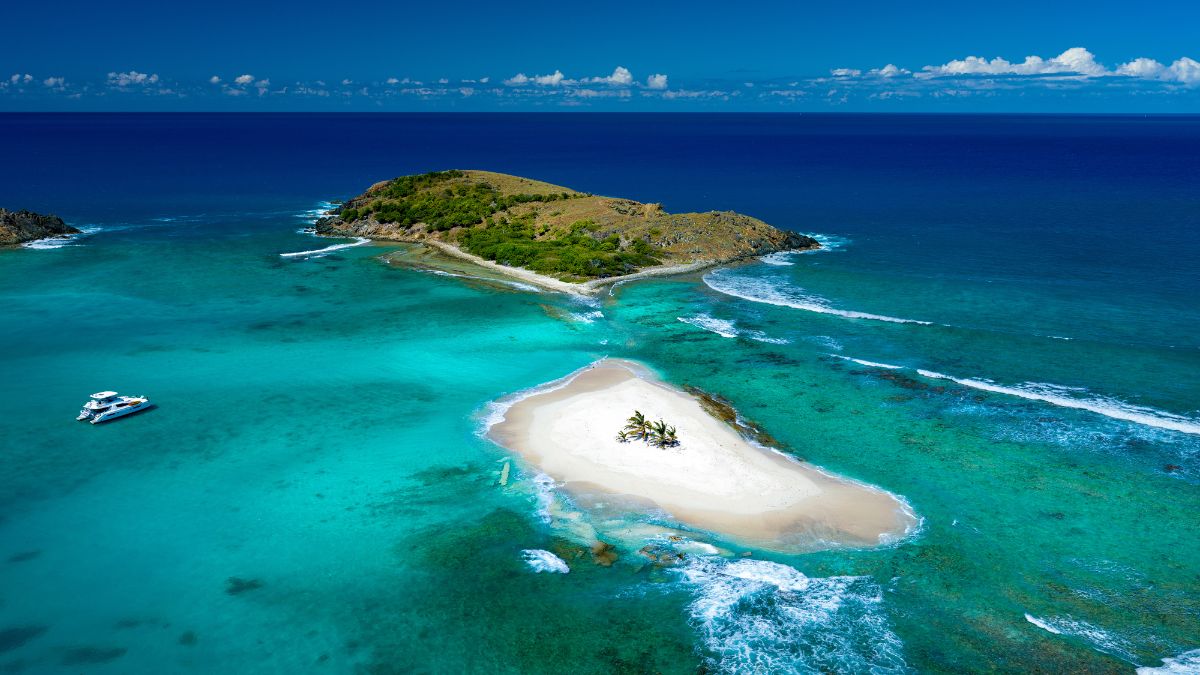
A short four-mile hop east brings you to Culebrita—a small uninhabited islet two miles off the eastern tip of Culebra, part of the Culebra National Wildlife Refuge. Culebrita has no permanent residents, no dock, no road, and no facilities. The whole island is about a half-mile across, ringed by beaches, capped by a hill with a lighthouse on top. It is the quietest stop on the chain.
Your captain drops the hook in the lee of the island and the day belongs to the beach. Playa Tortuga (Turtle Beach) on the south side is the headline anchorage—a small white-sand crescent named for the green sea turtles that nest on the beach in summer and graze the seagrass beds offshore year-round. Snorkel off the swim platform and there will be turtles. Park rules are strict (no chasing, no touching), and the population has rebounded over the past two decades to the point where multiple sightings per swim are routine.
Two extras worth the time. First: the hike up to the Faro de Culebrita on top of the hill—a Spanish Crown lighthouse built between 1882 and 1886, the oldest lighthouse in Puerto Rico, decommissioned in 1975 and now a roofless ruin with 360-degree views over the entire Spanish Virgin Islands and on a clear day all the way to St. Thomas. The trail up is twenty minutes from the beach, easy grade, well-marked. Second: "Los Jacuzzis"—a series of natural tide pools on the north side of the island, scoured by wave action over centuries into deep clear basins that fill and drain with each surge. They feel exactly like sitting in a hot tub, except the water is the color of a pool light.
Back aboard for sundowners and chef-prepared dinner, the boat sitting on its chain in one of the quietest anchorages anywhere in US waters.
Day Highlights
Day 6 of 7 · Town day + reef anchorage
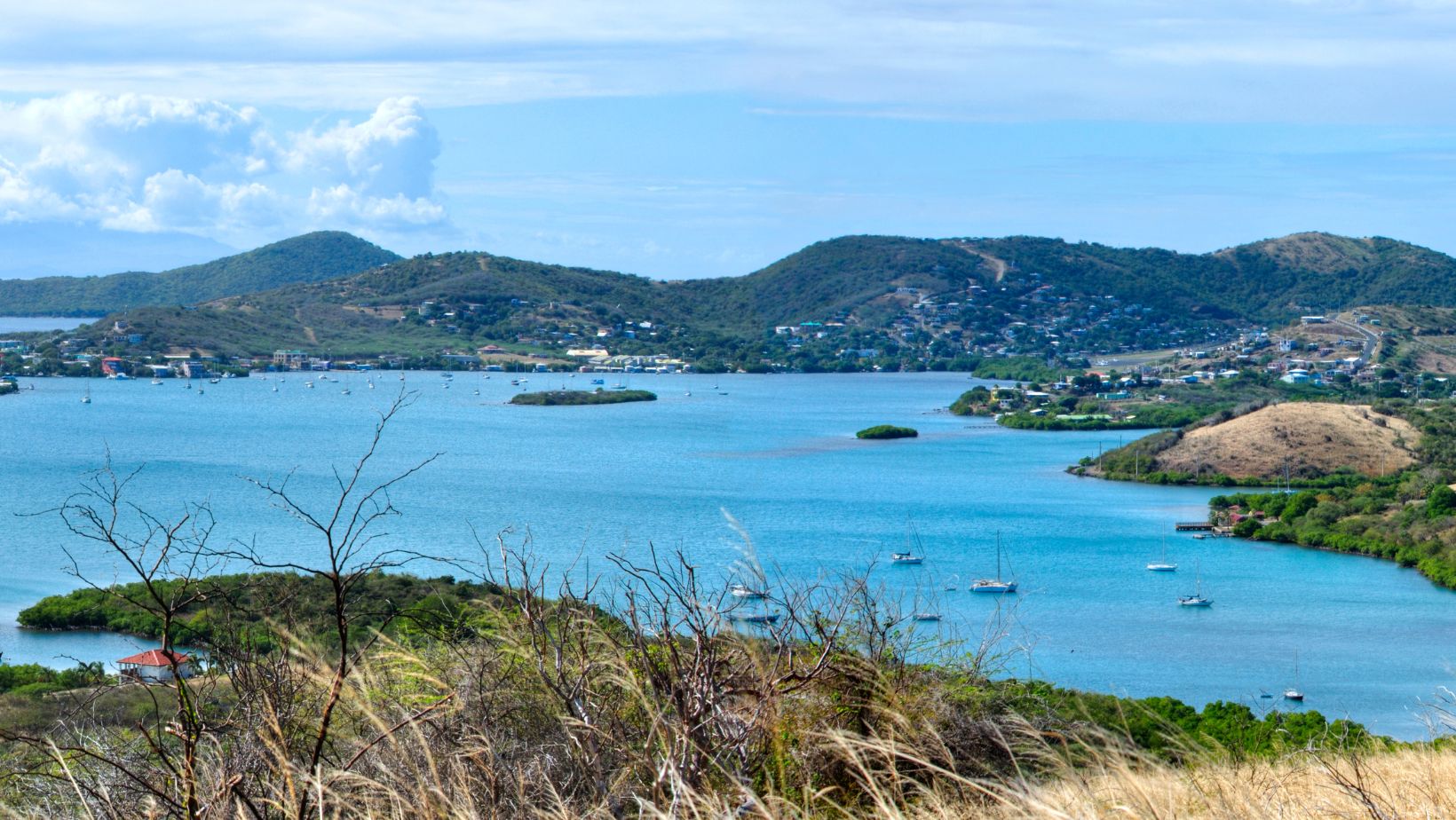
A short five-mile reach west takes you back across the channel to the Culebra mainland and into Bahía de Sardinas, the working anchorage on the western side of Dewey. Dewey is the only town on Culebra—locally everyone just calls it "Pueblo"—and it's small enough that you can walk the entire commercial district in fifteen minutes. Pastel-colored houses, a hand-cranked drawbridge over the Canal de Luis Peña that connects the south anchorage to the north, a couple of dive shops, a few small grocery stores, and the dinghy dock you'll tie up at when the captain runs you ashore.
Lunch is the easy headline. Mamacitas is the long-running waterfront classic—Caribbean fish, rice and beans, the harbor a few feet off the deck. Heather's Pizza is the locals' pick, just up the street from the bridge. Susie's, on the other side of the channel, runs to the upscale-but-still-island end and is worth booking ahead. Your captain knows the right call for the group. Walk the few blocks of town after lunch, pick up a t-shirt or a bottle of Pitorro from the small shops, and head back to the boat.
Mid-afternoon, your captain repositions a mile and a half south to Ensenada Dakity—a long, narrow bay tucked behind the Arrecife Dakity reef line on Culebra's south coast. The reef breaks the swell to flat, the holding is sand, and you anchor in fifteen feet of water with the reef a few hundred yards off the bow. It's the most comfortable overnight on the trip and one of the better snorkel sites on Culebra—the reef face is healthy, the visibility is consistently sixty to eighty feet, and you can roll off the swim platform in the morning straight into a wall of fish.
Dinner aboard at Dakity, sundowners on deck, and the last full night at anchor in the chain.
Day Highlights
Day 7 of 7 · Back to St. Thomas
The longest leg of the week and the one upwind day on the route—roughly twenty-five nautical miles east-southeast back across Vieques Sound and the channel to St. Thomas. The trades are on the nose at fifteen to twenty knots through the high season, which makes this either a long beat under canvas or a comfortable motorsail depending on the boat and the day. Your captain picks the start time around the morning's forecast and often runs the boat upwind early before the breeze builds.
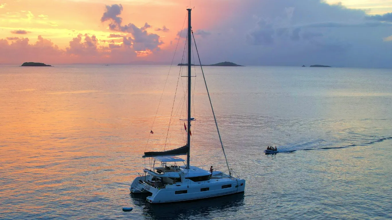
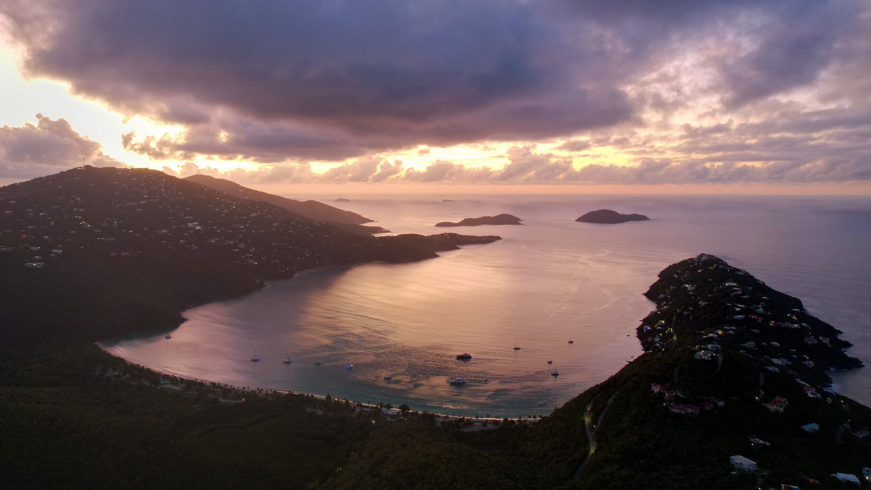
By mid-afternoon you're rounding the western tip of St. Thomas and into Magens Bay on the north coast—a deep, heart-shaped bay protected on three sides by hills, with a mile-long crescent of fine white sand at the head. National Geographic and Condé Nast Traveler have both ranked Magens among the top ten beaches in the Caribbean, and even after a week of empty Spanish Virgin Islands anchorages, it's still a strong closing shot. Anchor in the western corner where the holding is best, swim ashore, walk the beach, and have a Painkiller at the open-air bar at the head of the sand.
Final chef-prepared dinner aboard tonight—a slow three or four courses on the aft deck, the boat sitting on its chain in one of the prettiest bays in the eastern Caribbean, the lights of Magens running up the hillside behind you. Nightcap on deck, the last night of the trip at anchor.
Day Highlights
Day 8 · Departure
A last slow breakfast aboard at Magens Bay, a final swim off the back of the boat, and a short five-mile hop around the eastern tip of St. Thomas back into Yacht Haven Grande for your mid-morning departure. Your crew handles every logistic from the slip—transfer to Cyril E. King International, onward direct flights to Miami, Atlanta, Newark, JFK, Charlotte, and most major US East Coast hubs. Step off with a passport that never came out of your bag, a week of empty bays behind you, and the kind of quiet Caribbean week most charter guests don't believe still exists.
Want to share or come back to this voyage later?
Bookmark this voyage →
When to go, what it costs, and how to get there — the practical answers guests ask before booking a Spanish Virgin Islands crewed yacht charter.
December through April is the high-season window — the same trade-wind belt that makes the BVI a year-round charter destination. Steady east-northeast trades blow at 15 to 22 knots, daytime highs sit in the low 80s, humidity is low, and the cruising ground doesn't get the winter cold fronts that pass through the Bahamas. Rain when it comes is a brief passing shower or quick squall rather than a sustained downpour. The catch in the Spanish Virgin Islands is yacht availability, not crowds — the bays themselves stay uncrowded year-round, which is the whole point of the chain — but the boats that work the SVI loop come from the BVI and USVI, and those grounds peak the same weeks. Christmas, New Year, and Spring Break need 6 to 12 months of lead time.
May, June, and the back half of November sit between peak and the heart of hurricane risk. Water temperatures climb into the 80s, trade winds soften slightly to 12 to 18 knots, and rates typically fall 15 to 25 percent from peak. Tropical activity is statistically rare in those months, and the BVI/USVI inventory bottleneck eases — more boats free up to come over for an SVI week. For guests choosing between windows, this is typically the best the SVI offers.
Most charter yachts in the region head south to Grenada for hurricane season, and summer SVI inventory is thin to non-existent. A small number of boats stay in St. Thomas through the summer, and a handful can be repositioned northbound for an SVI trip in early summer or late autumn. If you're choosing a summer Caribbean charter, the Grenadines, Belize, or French Polynesia are typically better fits; we'll tell you when an SVI summer week makes sense and when it doesn't.
$25,000–$100,000 per week
Crewed yacht charters through the Spanish Virgin Islands typically run from $25,000 to $100,000+ per week, depending on yacht size, build year, and crew. Most yachts charter all-inclusive — the base weekly rate covers yacht, crew, all meals, a standard bar (beer, wine, spirits), fuel for normal cruising, water sports, and customary mooring fees. Select larger motor yachts run plus-expenses instead, where the base rate covers yacht and crew only and food, beverages, fuel, and dockage are paid through an Advance Provisioning Allowance (APA) — a pre-funded allowance set at 25 to 35 percent of the base rate, with itemized accounting and any unused balance refunded at trip end. There are no per-island customs or marine-park fees in the SVI; both Puerto Rico and the US Virgin Islands are US territory and the entire route clears as a domestic trip. A relocation fee applies on the rare charter that embarks from Puerto del Rey on the Puerto Rico mainland (the boats live in St. Thomas). Crew gratuities, customary at 15 to 20 percent of the base rate, are paid directly to the captain on disembarkation.
About chartering in the Spanish Virgin Islands.
Field-tested guides, itineraries, and tips — written from years of chartering these waters.

Explore the best Caribbean bareboat charter destinations: BVIs, Exuma, Spanish Virgin Islands, St. Vincent & the Grenadines, USVIs & Antigua.
We charter across the Caribbean. Here are some other excellent alternatives.

Explore a British Virgin Islands yacht charter for an unmatched sailing adventure. Idyllic Caribbean setting, easy navigation, and iconic beach bars await you.

Experience the charm of a US Virgin Islands yacht charter. Discover pristine national parks, stunning beaches, and easy navigation in this Caribbean gem.

Set sail in Exuma, Bahamas for an unparalleled yacht charter experience. Revel in the stunning blues, serene solitude, and fishing in this Caribbean gem.

Explore a St. Martin yacht charter for a unique Caribbean adventure. Enjoy stunning beaches, rich culture, and ideal sailing conditions.

Crewed catamaran and motor yacht charters through Bequia, Mustique, the Tobago Cays, Mayreau, and the southern Grenadines.

Embark on a Belize yacht charter to explore the Caribbean's unspoiled beauty, from vibrant reefs to serene cayes, in crystal-clear waters.
Fill out our quick form and we'll dive into your unique preferences — from adventure-packed itineraries to pampered escapes. Whether you're a seasoned voyager or new to charters, we'll tailor recommendations just for you.
With over fifteen years of experience, we'll match you with the yacht that fits your style, group, and itinerary. We work directly with the captains and crews across our list — so the recommendation is built around the right boat-and-crew fit for your week, not whatever's easiest to book.
Once your yacht is booked, we'll take care of logistics: paperwork, reminders, and personalized resources to help you plan. From arrival planning to must-visit spots, we'll make your charter as seamless as it is unforgettable.

What to Expect on a Private, Crewed Yacht Charter
Learn what makes crewed yacht charters extraordinary: personalized service, gourmet dining, and endless opportunities for adventure and relaxation.

How Does the Booking Process Work?
Our team handles every detail of your crewed yacht charter booking, ensuring a seamless experience from your first inquiry to setting sail.

Crewed Yacht Charter Pricing Explained
Understand what a crewed charter costs, the types of pricing, and what is included / not included.

Logistics: Proven Travel Plans for a Stress-Free Start
Plan your journey to your crewed yacht charter with ease. Tips on flights, transfers, and logistics for a stress-free start to your vacation.
Honeymoon Yacht Charters
Start your marriage on a private yacht. Explore secluded beaches, gourmet dining, and unforgettable sunsets in the Caribbean.
Family Yacht Charters
A crewed yacht charter is perfect for families of all ages. Safe, fun, and fully catered — your kids will never forget it.

Crewed Charter FAQ
Get answers to common questions about crewed yacht charters, from pricing and tipping to what's included and what to pack.

BVI Crewed Yacht Charters
The British Virgin Islands are the #1 crewed charter destination in the Caribbean. Short sails, protected waters, and world-class anchorages.

BVI Crewed Charter Guide
Everything you need to know before your BVI crewed catamaran charter — pricing, packing list, sample itinerary, and getting there.
Bahamas Crewed Yacht Charters
Explore the Exumas on a private crewed yacht. Swimming pigs, sandbars, and some of the clearest water on earth.
Caribbean Crewed Yacht Charters
All-inclusive crewed charters across the Caribbean — BVI, Bahamas, USVI, St. Martin, Antigua, and beyond.